Florida SS.6.G.2.3
The Standard
- SS.6.G.2
- Understand physical and cultural characteristics of places.
Analyze the relationship of physical geography to the development of ancient river valley civilizations.
Florida Next Generation Sunshine State Standards for Social Studies
Teacher's field guide
What This Standard Means
What Students Need to Do
- Students use maps and evidence to explain how rivers shaped farming, settlement, trade, and government in Mesopotamia, Egypt, the Indus Valley, and ancient China. They compare benefits and problems, including fertile soil, transportation, drought, and flooding.
What Mastery Looks Like
- Students connect a geographic feature to a specific result using clear cause-and-effect reasoning. They support comparisons with details from maps, images, or short sources.
Common Misconceptions
- Students may think rivers only helped people and overlook floods, drought, and irrigation work. They may confuse the locations and rivers of the four civilizations. Some claim geography completely determined human choices.
How to Assess It
- Give students a map of one civilization and ask: Name two river-related benefits, one challenge, and one development caused by them. Require map evidence.
Lesson moves
Ways to Teach It
Build a river valley in a foil tray with sand and water, then observe flooding, soil deposits, and possible settlement sites.
Write a claim answering: Which civilization gained the greatest geographic advantage from its river, and what evidence supports your choice?
Match cards showing rivers, civilizations, geographic conditions, and developments, then explain each completed set to a partner.
Compare an ancient settlement map with a modern local river map, then identify where people farm, travel, or manage flood risk.
Free download
Printable SS.6.G.2.3 Worksheet
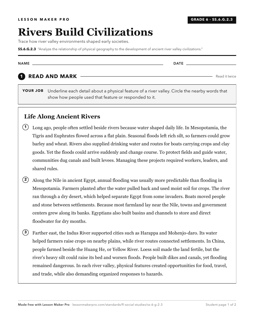
A ready-to-print activity worksheet aligned to SS.6.G.2.3, with an answer key for the teacher on its own page. No account needed.
PDF, US Letter, prints cleanly in black and white.
Download the worksheetKeep exploring
Related Standards
- SS.6.W.2.10
Compare the emergence of advanced civilizations in Mesoamerica and South America with the four early river valley civilizations.
- SS.6.W.2.4
Compare the economic, political, social, and religious institutions of ancient river civilizations.
- SS.6.G.5.2
Use geographic terms and tools to explain why ancient civilizations developed networks of highways, waterways, and other transportation linkages.
- SS.6.G.3.1
Explain how the physical landscape affected the development of agriculture and industry in the ancient world.
Turn this exact standard into a lesson
Grade, subject, topic, and the complete standard are prefilled. Create one free, no account needed.
Also for this standard:Make a WorksheetMake a QuizMake a Sub Lesson