Florida SS.6.G.2.5
The Standard
- SS.6.G.2
- Understand physical and cultural characteristics of places.
Interpret how geographic boundaries invite or limit interaction with other regions and cultures.
Florida Next Generation Sunshine State Standards for Social Studies
Teacher's field guide
What This Standard Means
What Students Need to Do
- Students read physical and political maps to identify mountains, rivers, seas, deserts, and national borders. They explain how each boundary can increase or reduce trade, migration, communication, conflict, and cultural exchange.
What Mastery Looks Like
- Given a map, students predict where interaction is likely and support the prediction with map evidence. They explain why one feature, such as a river, can serve as both a route and a barrier.
Common Misconceptions
- Students often assume every boundary blocks contact and every river or sea has the same effect. They may ignore roads, passes, ports, laws, and technology, or claim that geography alone determines how cultures interact.
How to Assess It
- Project a map showing two regions separated by mountains, with one pass and a river connecting market towns. Ask students to name one limit and one opportunity for interaction, citing one map detail for each.
Lesson moves
Ways to Teach It
Build tabletop maps with clay mountains, blue yarn rivers, and paper borders, then place trade routes and explain each choice.
Write: Which boundary would most affect contact between two communities, a desert, river, sea, or national border, and why?
Play Boundary Match by pairing feature cards with trade, migration, or communication effects, then defend each match to a partner.
Compare Mediterranean port cities with Himalayan communities on a map, then list how water routes and mountains shape contact.
Free download
Printable SS.6.G.2.5 Worksheet
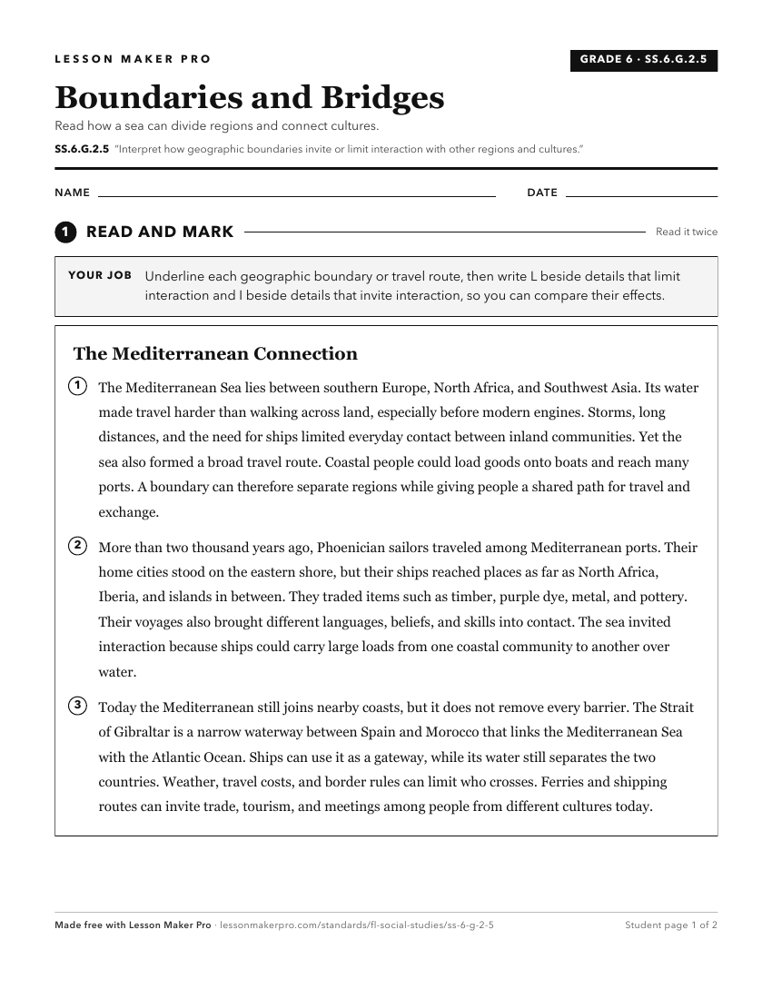
A ready-to-print activity worksheet aligned to SS.6.G.2.5, with an answer key for the teacher on its own page. No account needed.
PDF, US Letter, prints cleanly in black and white.
Download the worksheetKeep exploring
Related Standards
- SS.8.G.6
Understand how to apply geography to interpret the past and present and plan for the future.
- SS.7.G.1.3
Interpret maps to identify geopolitical divisions and boundaries of places in North America.
- SS.8.G.4.4
Interpret databases, case studies and maps to describe the role that regions play in influencing trade, migration patterns, and cultural or political interactio...
- SS.6.G.6
Understand how to apply geography to interpret the past and present and plan for the future.
Turn this exact standard into a lesson
Grade, subject, topic, and the complete standard are prefilled. Create one free, no account needed.
Also for this standard:Make a WorksheetMake a QuizMake a Sub Lesson