Florida SS.6.G.1.5
The Standard
- SS.6.G.1
- Understand how to use maps and other geographic representations, tools, and technology to report information.
Use scale, cardinal and intermediate directions, and estimation of distances between places on current and ancient maps of the world.
Florida Next Generation Sunshine State Standards for Social Studies
Teacher's field guide
What This Standard Means
What Students Need to Do
- Students use a compass rose to describe where places are located in relation to one another. They measure map distances, apply the scale, and make reasonable estimates on modern and ancient maps.
What Mastery Looks Like
- A student can identify cardinal and intermediate directions between two places. The student can measure a map route, convert it using the scale, and explain whether the result is reasonable.
Common Misconceptions
- Students may confuse east and west or mix up northeast and northwest. They may treat centimeters on the map as actual miles, ignore the scale, or assume ancient maps show exact distances.
How to Assess It
- Give students one current map and one ancient map with marked locations. Ask them to name the direction and estimate the real distance between each pair.
Lesson moves
Ways to Teach It
Give pairs rulers and string to measure straight and curved routes between cities on printed current and ancient maps, then convert using each scale.
Ask students to write how direction and estimated distance between two cities differ across a current map and an ancient map.
Play Map Mission cards where teams locate city pairs, state the direction, measure the gap, and earn points for accurate scale conversions.
Have students plan a flight between two world cities, reporting the compass direction and estimated distance from a current airline map.
Free download
Printable SS.6.G.1.5 Worksheet
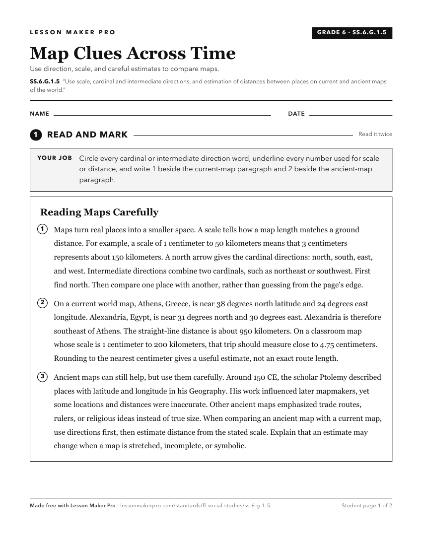
A ready-to-print activity worksheet aligned to SS.6.G.1.5, with an answer key for the teacher on its own page. No account needed.
PDF, US Letter, prints cleanly in black and white.
Download the worksheetKeep exploring
Related Standards
- SS.4.G.1.4
Interpret political and physical maps using map elements (title, compass rose, cardinal directions, intermediate directions, symbols, legend, scale, longitude, ...
- SS.6.G.1.7
Use maps to identify characteristics and boundaries of ancient civilizations that have shaped the world today.
- SS.6.G.6.2
Compare maps of the world in ancient times with current political maps.
- SS.3.G.1.6
Use maps to identify different types of scale to measure distances between two places.
Turn this exact standard into a lesson
Grade, subject, topic, and the complete standard are prefilled. Create one free, no account needed.
Also for this standard:Make a WorksheetMake a QuizMake a Sub Lesson