Florida SS.5.G.4.1
The Standard
- SS.5.G.4
- Uses of Geography
Use geographic knowledge and skills when discussing current events.
Florida Next Generation Sunshine State Standards for Social Studies
Teacher's field guide
What This Standard Means
What Students Need to Do
- Students locate where a news event happened and describe that place using maps. They explain how location, climate, landforms, resources, or movement relate to the event.
What Mastery Looks Like
- A student can identify the correct city, state, country, or region and name nearby geographic features. The student uses evidence from a map and news source to explain a geographic connection.
Common Misconceptions
- Students may confuse a city with a country or a country with a continent. They may name the article’s publication location instead of the event location, or treat geography as only landforms.
How to Assess It
- Give students a short news brief and a blank map. Ask them to mark the event location, label one nearby feature, and explain how location affected the event.
Lesson moves
Ways to Teach It
Give pairs a printed news brief and atlas, then have them pin the event on a wall map and add one geographic fact.
Ask, “How did location shape this event?” Students cite one map detail and one article detail in a three-sentence response.
Play Map Clue Relay: teams use continent, country, direction, distance, and nearby features to identify locations from current event cards.
Track one week of local weather alerts, then map affected places and explain how coastlines, rivers, or elevation influence each alert.
Free download
Printable SS.5.G.4.1 Worksheet
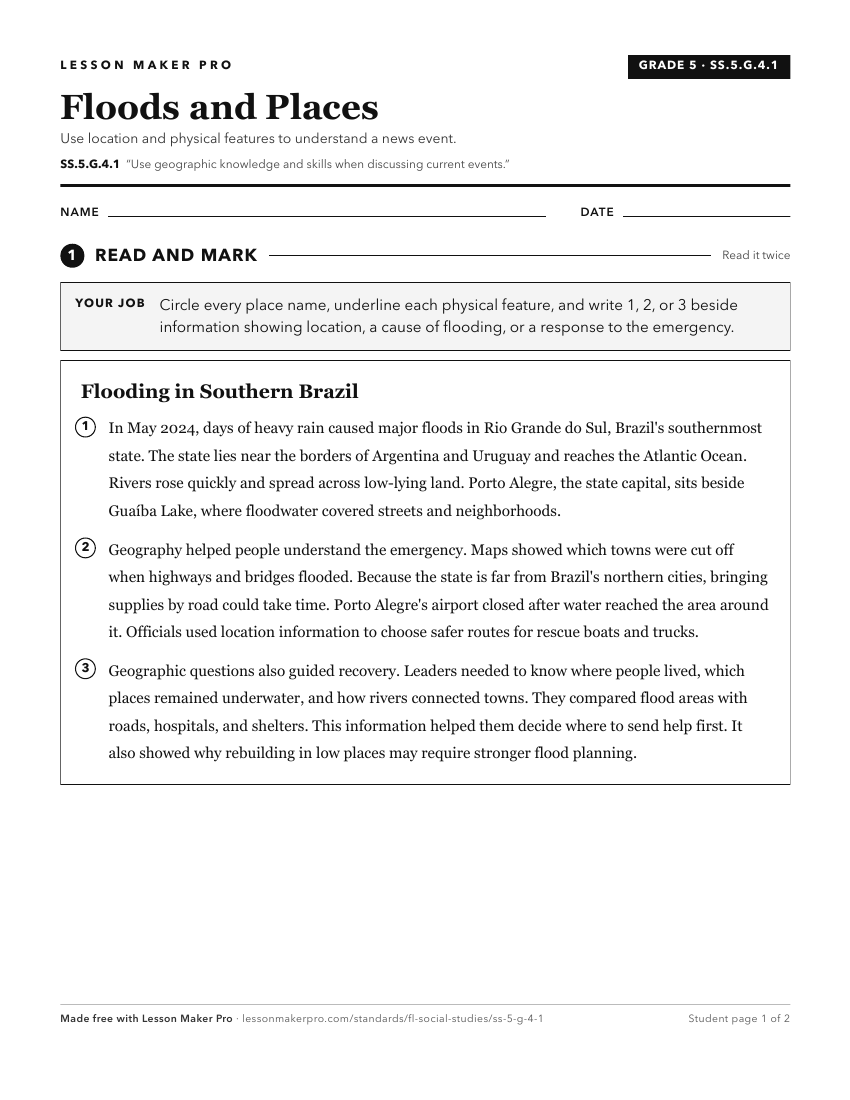
A ready-to-print activity worksheet aligned to SS.5.G.4.1, with an answer key for the teacher on its own page. No account needed.
PDF, US Letter, prints cleanly in black and white.
Download the worksheetKeep exploring
Related Standards
- SS.5.G.4.2
Use geography concepts and skills such as recognizing patterns, mapping, and graphing to find solutions for local, state, or national problems.
- SS.8.G.6
Understand how to apply geography to interpret the past and present and plan for the future.
- SS.6.G.6
Understand how to apply geography to interpret the past and present and plan for the future.
- SS.5.G.1.1
Interpret current and historical information using a variety of geographic tools.
Turn this exact standard into a lesson
Grade, subject, topic, and the complete standard are prefilled. Create one free, no account needed.
Also for this standard:Make a WorksheetMake a QuizMake a Sub Lesson