Florida SS.5.G.1.1
The Standard
- SS.5.G.1
- The World in Spatial Terms
Interpret current and historical information using a variety of geographic tools.
Florida Next Generation Sunshine State Standards for Social Studies
Teacher's field guide
What This Standard Means
What Students Need to Do
- Students read maps, globes, charts, and digital map layers to find locations, patterns, and changes. They use titles, legends, scales, symbols, and direction to support conclusions.
What Mastery Looks Like
- Students select the right geographic tool for a question and explain what it shows. They compare older and newer maps and cite visible evidence of change.
Common Misconceptions
- Students may treat all maps as current or assume every map uses the same symbols and scale. They may describe locations without using the legend, compass rose, or map evidence.
How to Assess It
- Give students historical and current maps of the same Florida city. Ask them to name two changes and cite one map feature that proves each change.
Lesson moves
Ways to Teach It
Give pairs two printed maps, sticky notes, and string, then have them mark changes in roads, land use, and settlement.
Ask students to write: Which map tool best shows population change over time, and what evidence would you expect to see?
Play Map Tool Match by having teams pair question cards with a globe, road map, population map, satellite image, or historical map.
Use a current hurricane tracking map to identify direction, distance, nearby places, and areas that may need to prepare.
Free download
Printable SS.5.G.1.1 Worksheet
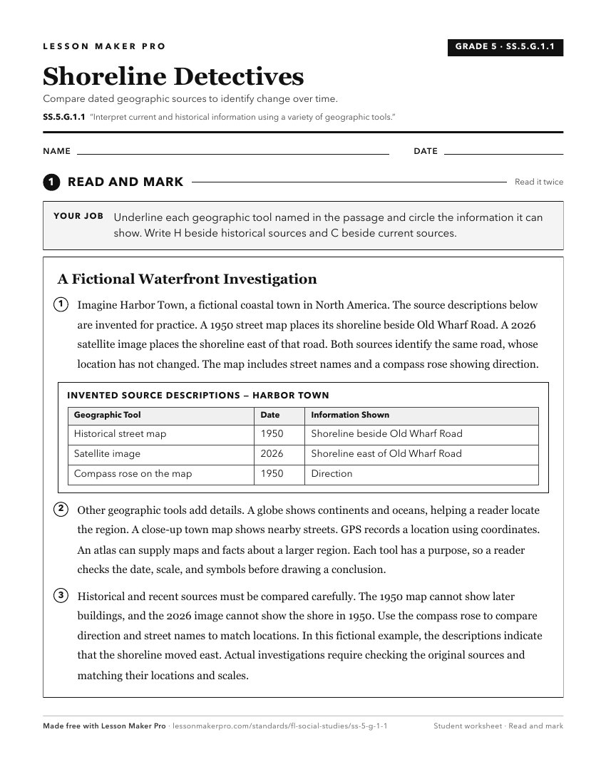
A ready-to-print activity worksheet aligned to SS.5.G.1.1, with an answer key for the teacher on its own page. No account needed.
PDF, US Letter, prints cleanly in black and white.
Download the worksheetKeep exploring
Related Standards
- SS.8.G.6
Understand how to apply geography to interpret the past and present and plan for the future.
- SS.8.G.1
Understand how to use maps and other geographic representations, tools, and technology to report information.
- SS.7.G.1
Understand how to use maps and other geographic representations, tools, and technology to report information.
- SS.6.G.1.4
Utilize tools geographers use to study the world.
Turn this exact standard into a lesson
Grade, subject, topic, and the complete standard are prefilled. Create one free, no account needed.
Also for this standard:Make a WorksheetMake a QuizMake a Sub Lesson