Florida SS.3.G.2.3
The Standard
- SS.3.G.2
- Places and Regions
Label the states in each of the five regions of the United States.
Florida Next Generation Sunshine State Standards for Social Studies
Teacher's field guide
What This Standard Means
What Students Need to Do
- Students locate each state on a U.S. map and write its name in the correct place. They group states into Northeast, Southeast, Midwest, Southwest, and West using the class reference map.
What Mastery Looks Like
- On an unlabeled map, a student can accurately name and locate all 50 states. The student assigns each state to the correct region, including small states, Alaska, and Hawaii.
Common Misconceptions
- Students may place every northern state in the Northeast or every western state in the West. They often confuse Midwest and Southwest states, mislabel small Northeast states, or omit Alaska and Hawaii.
How to Assess It
- Give students a blank map with Maine, Ohio, Florida, Texas, and California numbered. Ask them to name each state and write its region.
Lesson moves
Ways to Teach It
Give pairs a blank U.S. map and state-name sticky notes; students place each note, then shade the five regions with different colors.
Ask, “Which states sit near a regional boundary, and what map clues help you place them in the assigned region?”
Play Region Relay: teams draw a state card, point to it on a wall map, and name its region for one point.
Plan a five-stop road trip with one state in each region, then mark the route and list every state crossed.
Free download
Printable SS.3.G.2.3 Worksheet
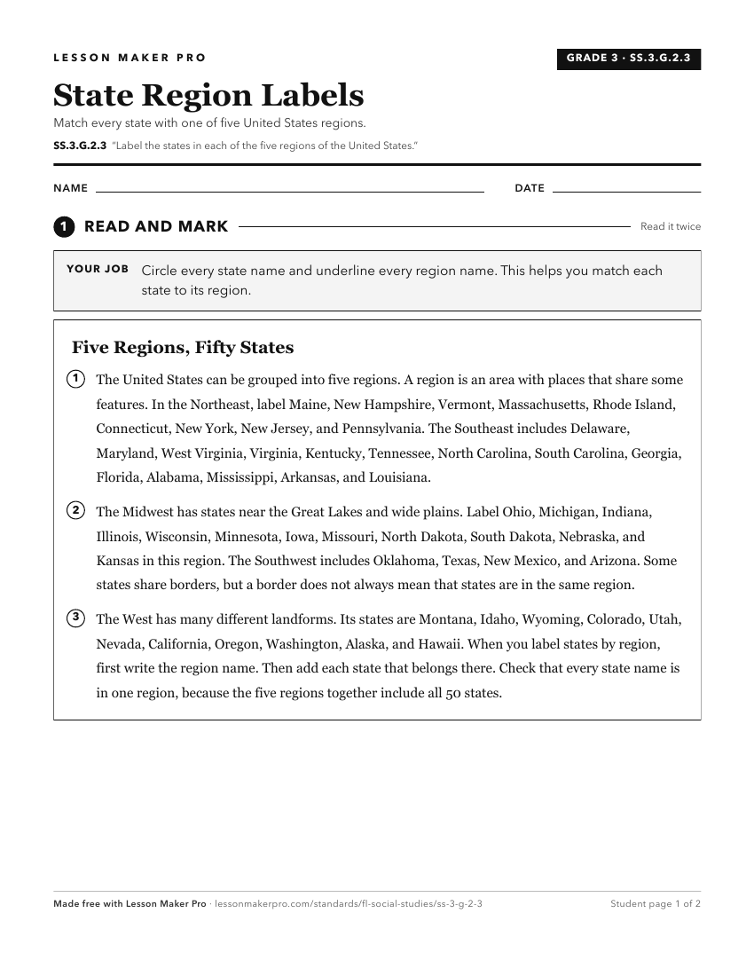
A ready-to-print activity worksheet aligned to SS.3.G.2.3, with an answer key for the teacher on its own page. No account needed.
PDF, US Letter, prints cleanly in black and white.
Download the worksheetKeep exploring
Related Standards
- SS.7.G.1.1
Locate the fifty states and their capital cities in addition to the nation's capital on a map.
- SS.5.G.1.6
Locate and identify states, capitals, and United States Territories on a map.
- SS.8.G.3.1
Locate and describe in geographic terms the major ecosystems of the United States.
- SS.3.G.2.2
Identify the five regions of the United States.
Turn this exact standard into a lesson
Grade, subject, topic, and the complete standard are prefilled. Create one free, no account needed.
Also for this standard:Make a WorksheetMake a QuizMake a Sub Lesson