Alabama Science ESS.4
Standard Cluster
Obtain, evaluate, and communicate information about the geologic conditions and processes that form different Earth materials. a. Plan and carry out investigations to explore the processes that form plutonic (intrusive) and volcanic (extrusive) igneous rocks of differing compositions and textures. b. Analyze and interpret data to explain the effects of mechanical and chemical weathering and erosion on Earth’s materials by wind, water, ice, and gravity. c. Construct an explanation using evidence from experiments, models, or data of the processes that create and transform igneous, sedimentary, and metamorphic rocks. d. Plan and conduct an investigation on water’s effect on surface and subsurface processes. e. Obtain and communicate information about significant geologic characteristics in Alabama and the southeastern United States.
2023 Alabama Course of Study: Science · Earth’s Systems
Cluster contents
Standards in This Cluster
ESS.4 is a cluster heading. These are the individual standards under it.
- ESS.4.a
Plan and carry out investigations to explore the processes that form plutonic (intrusive) and volcanic (extrusive) igneous rocks of differing compositions and t...
- ESS.4.b
Analyze and interpret data to explain the effects of mechanical and chemical weathering and erosion on Earth’s materials by wind, water, ice, and gravity.
- ESS.4.c
Construct an explanation using evidence from experiments, models, or data of the processes that create and transform igneous, sedimentary, and metamorphic rocks...
- ESS.4.d
Plan and conduct an investigation on water’s effect on surface and subsurface processes.
- ESS.4.e
Obtain and communicate information about significant geologic characteristics in Alabama and the southeastern United States.
Teacher's field guide
What This Cluster Means
What Students Need to Do
- Students use rock samples and data to connect crystal size and composition to how and where magma cooled. They explain how weathering, erosion, deposition, heat, and pressure change rocks. They test how water moves through earth materials and use Alabama maps to identify local rock and landforms.
What Mastery Looks Like
- A student can use color and crystal size to compare granite and basalt and explain where each formed. They can trace how weathered rock becomes sandstone, then how heat and pressure turn sandstone into quartzite. They can use an Alabama geologic map to explain why rain dissolves northern limestone or moves Coastal Plain sand.
Common Misconceptions
- Students may think every igneous rock forms from lava at the surface. They may call sediment carried by a stream weathering, rather than erosion, or mistake dissolving limestone for physical breakage. Some think rocks change type just by getting older.
How to Assess It
- Show photos of granite and basalt. Ask students which cooled underground, which cooled at the surface, and what in each photo supports their answer.
Lesson moves
Ways to Teach It
Pour equal amounts of water over tilted trays of sand and gravel; compare runoff, sediment movement, and water that drains through.
Show granite, basalt, rhyolite, and gabbro photos; ask students how color and crystal size help them infer composition and cooling location.
Give pairs rock and process cards; have them build a path from magma to sandstone to quartzite and explain each step.
Use an Alabama geologic map to find limestone near Huntsville and Coastal Plain sand; ask where rain is more likely to form caves.
Free download
Printable ESS.4 Worksheet
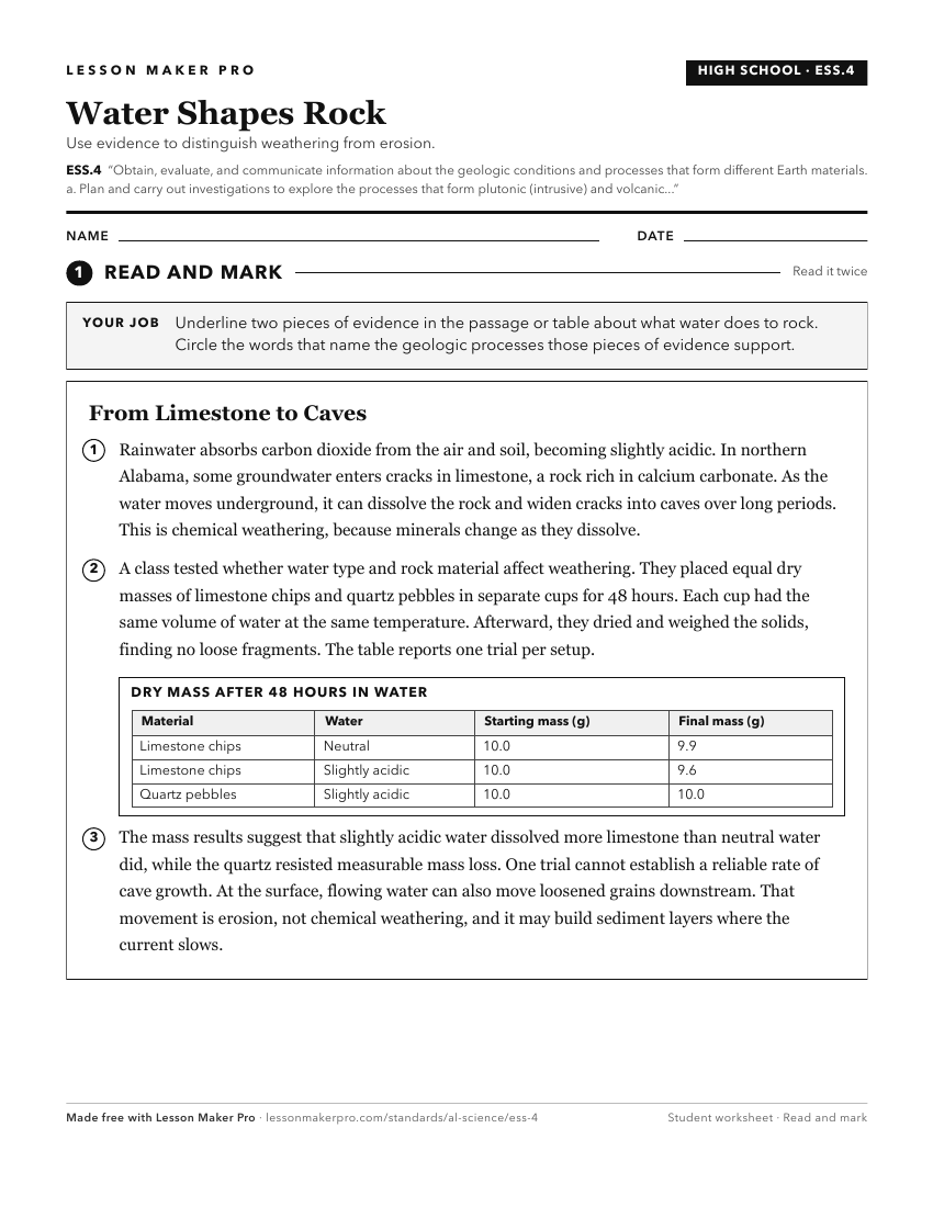
A ready-to-print activity worksheet aligned to ESS.4, with an answer key for the teacher on its own page. No account needed.
PDF, US Letter, prints cleanly in black and white.
Download the worksheetKeep exploring
Related Standards
- ESS.5
Obtain, evaluate, and communicate information about major events in Earth’s history.
- 6.5
Obtain, evaluate, and communicate evidence that explains how constructive and destructive processes shape Earth’s surface.
- ES.7
Obtain, evaluate, and communicate information to describe the development, management, and recycling of mineral resources.
- ESS.6
Obtain, evaluate, and communicate information about the theory of plate tectonics.
Turn this cluster into a lesson
Grade, subject, topic, and the complete cluster are prefilled. Create one free, no account needed.
Also for this cluster:Make a WorksheetMake a QuizMake a Sub Lesson