Alabama Science 6.5
Standard Cluster
Obtain, evaluate, and communicate evidence that explains how constructive and destructive processes shape Earth’s surface. a. Develop and use models to demonstrate the processes that form rocks and cycle Earth’s materials. b. Construct an evidence-based explanation of how rocks are classified as metamorphic, igneous, or sedimentary based on their characteristics and the process of the rock cycle. c. Develop and use models to demonstrate types of weathering, effects of agents of erosion and transportation, and the formation of environments of deposition. d. Use research-based evidence to propose a scientific explanation of how the distribution of Earth’s resources, including minerals, fossil fuels, and groundwater, results from ongoing geoscience processes.
2023 Alabama Course of Study: Science · Earth’s Systems: Materials and Processes
Cluster contents
Standards in This Cluster
6.5 is a cluster heading. These are the individual standards under it.
- 6.5.a
Develop and use models to demonstrate the processes that form rocks and cycle Earth’s materials.
- 6.5.b
Construct an evidence-based explanation of how rocks are classified as metamorphic, igneous, or sedimentary based on their characteristics and the process of th...
- 6.5.c
Develop and use models to demonstrate types of weathering, effects of agents of erosion and transportation, and the formation of environments of deposition.
- 6.5.d
Use research-based evidence to propose a scientific explanation of how the distribution of Earth’s resources, including minerals, fossil fuels, and groundwater,...
Teacher's field guide
What This Cluster Means
What Students Need to Do
- Students model how rocks form and change. They identify rock types by their traits and explain how weathering, erosion, and deposition shape land. They use evidence to explain where minerals, fossil fuels, and groundwater occur.
What Mastery Looks Like
- A student identifies a rock type from clues such as layers, crystals, or bands and explains how it formed. Their model shows more than one path through the rock cycle and tracks where sediment moves and settles. They use a map or reading to explain why a resource occurs in a particular rock layer.
Common Misconceptions
- Students may think every rock follows one fixed path through the rock cycle. They may call moving sediment weathering, when weathering breaks rock and erosion carries it away. They may assume resources are spread evenly underground.
How to Assess It
- Draw a cracked cliff, a river carrying sand, and a lake with layered rock beneath it. Ask students to label weathering, erosion, and deposition, then identify the rock type beneath the lake.
Lesson moves
Ways to Teach It
Crumble a cracker onto a sloped baking tray, pour a little water downhill, and label weathering, erosion, and deposition.
Show photos of layered sandstone, speckled granite, and banded gneiss; ask students which visible clues reveal how each formed.
Give pairs rock and process cards; have them build two different rock cycle paths and explain each change to a partner.
Print Alabama coal deposit and geologic maps; students mark overlaps and explain why ancient swamp plants left coal in those layers.
Free download
Printable 6.5 Worksheet
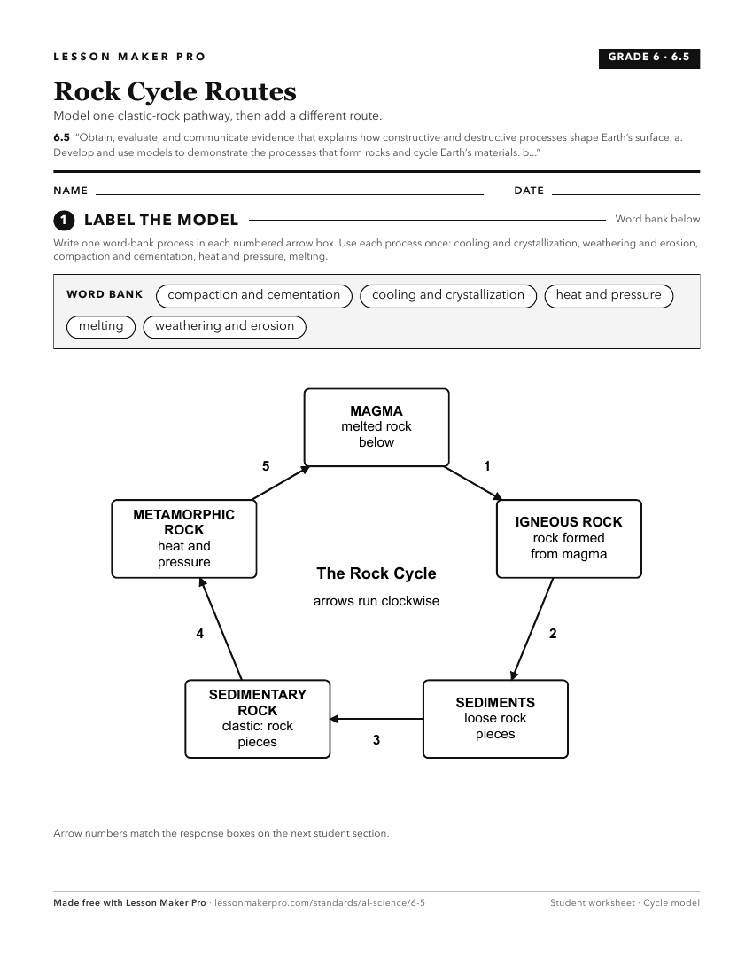
A ready-to-print activity worksheet aligned to 6.5, with an answer key for the teacher on its own page. No account needed.
PDF, US Letter, prints cleanly in black and white.
Download the worksheetKeep exploring
Related Standards
- ESS.4
Obtain, evaluate, and communicate information about the geologic conditions and processes that form different Earth materials.
- 6.6
Construct an evidence-based explanation of how tectonic plate movement impacts Earth’s surface over geological time.
- ES.9
Obtain, evaluate, and communicate information based on evidence to explain how key natural resources, natural hazards, and climate variability influence human a...
- 4.11
Construct explanations of Earth's changes over time through slow and rapid processes, citing evidence found in rock formations and fossils in rock layers.
Turn this cluster into a lesson
Grade, subject, topic, and the complete cluster are prefilled. Create one free, no account needed.
Also for this cluster:Make a WorksheetMake a QuizMake a Sub Lesson