Virginia SOL WG.9.b
The Standard
- WG.9
- The student will analyze the characteristics of the regions of South Asia and Southeast Asia by
describing major physical and environmental features and how geography may change over time
Virginia Standards of Learning for History and Social Science · The student will analyze the characteristics of the regions of South Asia and Southeast Asia by
Teacher's field guide
What This Standard Means
What Students Need to Do
- Students locate and describe mountains, rivers, plains, deltas, islands, and monsoon zones across South Asia and Southeast Asia. They explain how floods, erosion, tectonic activity, sea level rise, and human actions reshape places over time.
What Mastery Looks Like
- Students accurately label major features such as the Himalayas, Ganges River, Mekong River, and Indonesian archipelago. They use geographic evidence to explain one past or possible future change to a landscape.
Common Misconceptions
- Students may confuse monsoons with constant rain or treat South Asia and Southeast Asia as one region. They may also assume borders and landforms never change or that all geographic change is caused by people.
How to Assess It
- Give students a blank regional map and ask them to label two physical features. Then have them explain one way water, tectonic activity, or people could change one labeled place.
Lesson moves
Ways to Teach It
Build clay mountains and river deltas in trays, then pour water to observe runoff, erosion, and sediment buildup.
Write a claim explaining whether monsoons help or harm communities, using one benefit and one risk as evidence.
Play a map card sort matching landforms, waterways, climate patterns, and hazards to South Asia or Southeast Asia.
Compare satellite images of the Mekong Delta from two years, then identify visible land or water changes and likely causes.
Free download
Printable WG.9.b Worksheet
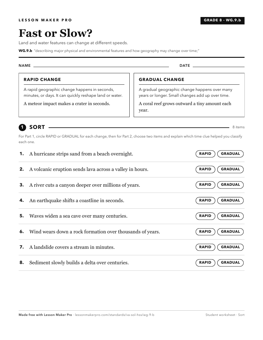
A ready-to-print activity worksheet aligned to WG.9.b, with an answer key for the teacher on its own page. No account needed.
PDF, US Letter, prints cleanly in black and white.
Download the worksheetKeep exploring
Related Standards
Turn this exact standard into a lesson
Grade, subject, topic, and the complete standard are prefilled. Create one free, no account needed.
Also for this standard:Make a WorksheetMake a QuizMake a Sub Lesson