Virginia SOL WG.3
SOL Standard (Skills Cluster)
The student will analyze the characteristics of the regions of the United States and Canada by identifying and analyzing the location of major geographic regions and major cities on maps and globes; describing major physical and environmental features and how geography may change over time; analyzing cultural influences and landscapes; and explaining important economic characteristics, including the distribution of economic activities and global trade.
Virginia Standards of Learning for History and Social Science
Cluster contents
Skills in This Standard
WG.3 is a Standards of Learning history and social science standard. These are the skills expectations under it.
- WG.3.a
identifying and analyzing the location of major geographic regions and major cities on maps and globes
- WG.3.b
describing major physical and environmental features and how geography may change over time
- WG.3.c
analyzing cultural influences and landscapes
- WG.3.d
explaining important economic characteristics, including the distribution of economic activities and global trade.
Teacher's field guide
What This Cluster Means
What Students Need to Do
- Students locate major U.S. and Canadian regions and cities on maps and globes. They explain how physical features, environmental change, culture, and economic activity shape each region and its trade links.
What Mastery Looks Like
- A student can accurately label major regions and cities and use map evidence to compare two regions. The student can connect landforms, climate, settlement, culture, industry, and trade with clear cause-and-effect explanations.
Common Misconceptions
- Students may treat region boundaries as fixed political borders or confuse physical regions with states and provinces. They may assume geography never changes, or list industries and cultural traits without explaining why they developed there. They may also mistake a major city for a capital.
How to Assess It
- Give students a blank U.S. and Canada map. Ask them to label two regions and two cities, then explain how one physical feature affects culture, economic activity, or trade.
Lesson moves
Ways to Teach It
Build a floor map with yarn, landform cards, city cards, and trade arrows, then have groups explain each placement.
Write: How would the Rocky Mountains shape settlement, culture, transportation, and trade differently from the Great Lakes region?
Play Region Relay: teams place city, landform, industry, and cultural feature cards on a blank map, earning points for accurate explanations.
Trace a grocery product’s route from a U.S. or Canadian region to your town, noting resources, transportation, and trade partners.
Free download
Printable WG.3 Worksheet
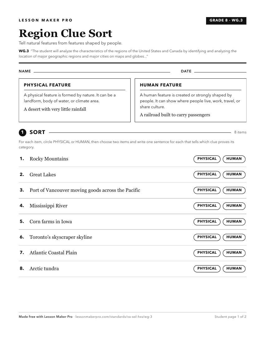
A ready-to-print activity worksheet aligned to WG.3, with an answer key for the teacher on its own page. No account needed.
PDF, US Letter, prints cleanly in black and white.
Download the worksheetKeep exploring
Related Standards
- WG.5
The students will analyze the characteristics of the regions of Europe by
- WG.8
The student will analyze the characteristics of the regions of North Africa and Southwest Asia by
- WG.4
The student will analyze the characteristics of the regions of Latin America and the Caribbean by
- USI.1
The student will apply history and social science skills to understand the geography of North America by
Turn this cluster into a lesson
Grade, subject, topic, and the complete cluster are prefilled. Create one free, no account needed.
Also for this cluster:Make a WorksheetMake a QuizMake a Sub Lesson