Virginia SOL WG.17
SOL Standard (Skills Cluster)
The student will apply history and social science skills to analyze strategic geographic features and resources by identifying and describing examples of disputed borders and explaining the reasons for the disputes; describing and explaining examples of the different types of conflicts that may erupt between and among nations; and analyzing the types of conflicts and cooperation that can occur over the use of rivers and bodies of water.
Virginia Standards of Learning for History and Social Science
Cluster contents
Skills in This Standard
WG.17 is a Standards of Learning history and social science standard. These are the skills expectations under it.
- WG.17.a
identifying and describing examples of disputed borders and explaining the reasons for the disputes
- WG.17.b
describing and explaining examples of the different types of conflicts that may erupt between and among nations
- WG.17.c
analyzing the types of conflicts and cooperation that can occur over the use of rivers and bodies of water.
Teacher's field guide
What This Cluster Means
What Students Need to Do
- Students use maps, short histories, and data to explain why countries claim the same territory or resources. They classify conflicts by cause and explain how shared water can lead to tension, negotiation, or agreements.
What Mastery Looks Like
- Given a case, students can locate the disputed feature, describe each side’s claim, and support the likely cause with evidence. They can explain how countries sharing water might compete and how a treaty or joint plan could reduce conflict.
Common Misconceptions
- Students may assume borders are natural, permanent, and accepted by everyone. They may treat every disagreement as a war or assume all conflicts have one cause. They may also overlook how upstream actions affect downstream countries.
How to Assess It
- Give students a map of Kashmir and the Indus River plus a 100 word case summary. Ask, “Why is the border disputed, what type of conflict is shown, and how can the river create both conflict and cooperation?”
Lesson moves
Ways to Teach It
Pairs build a tabletop border dispute with tape, river string, and resource tokens, then explain why each fictional country claims the area.
Prompt students: Should historical control, current population, or resource access matter most when drawing a border? Require two reasons and a counterclaim.
Run a case card sort where teams classify conflicts as territorial, resource, political, economic, ethnic, or religious, then defend one placement.
Use a Nile dam news map and have teams draft one rule that protects both upstream and downstream water needs.
Free download
Printable WG.17 Worksheet
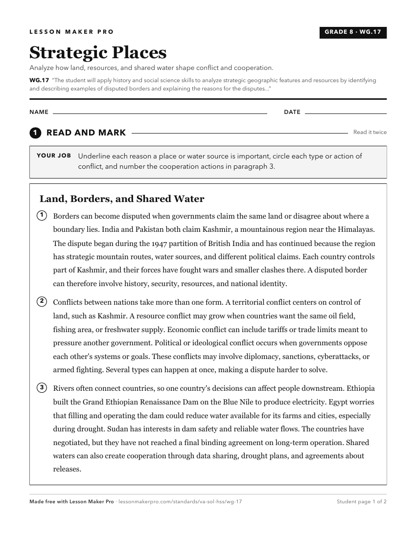
A ready-to-print activity worksheet aligned to WG.17, with an answer key for the teacher on its own page. No account needed.
PDF, US Letter, prints cleanly in black and white.
Download the worksheetKeep exploring
Related Standards
- 1.6
The student will apply history and social science skills to develop geographic skills by
- WG.2
The student will apply history and social science skills to evaluate the significance of natural, human, and capital resources by
- USII.9
The student will apply history and social science skills by
- WG.1
The student will apply history and social science skills to explain how geographic information and geospatial tools are used to make decisions by
Turn this cluster into a lesson
Grade, subject, topic, and the complete cluster are prefilled. Create one free, no account needed.
Also for this cluster:Make a WorksheetMake a QuizMake a Sub Lesson