Virginia SOL 3.6.b
The Standard
- 3.6
- The student will apply history and social science skills to describe the geographic, political, economic, and social structures and innovations of ancient Greece by
describing the unique geography of ancient Greece
Virginia Standards of Learning for History and Social Science
Teacher's field guide
What This Standard Means
What Students Need to Do
- Students locate ancient Greece on a map of the Mediterranean region. They describe its mountains, rocky land, peninsulas, islands, and surrounding seas.
What Mastery Looks Like
- Students accurately label Greece, the Mediterranean Sea, and the Aegean Sea on a simple map. They explain how mountains separated communities and how seas supported travel and trade.
Common Misconceptions
- Students may picture Greece as one large, flat land area or confuse it with an island. They may also assume mountains made travel easier or that rocky soil supported abundant farming.
How to Assess It
- Give students an unlabeled map of Greece. Ask them to label two seas, mark mountains and islands, then write one way geography affected daily life.
Lesson moves
Ways to Teach It
Build Greece in a tray using clay for mountains, sand for limited farmland, and blue paper for surrounding seas.
Ask students to write: How would mountains and many islands affect travel between Greek communities?
Play map feature bingo using mountain, peninsula, island, rocky soil, Aegean Sea, and Mediterranean Sea cards.
Compare a photo of a Greek island with your local landscape, then list three geographic differences.
Free download
Printable 3.6.b Worksheet
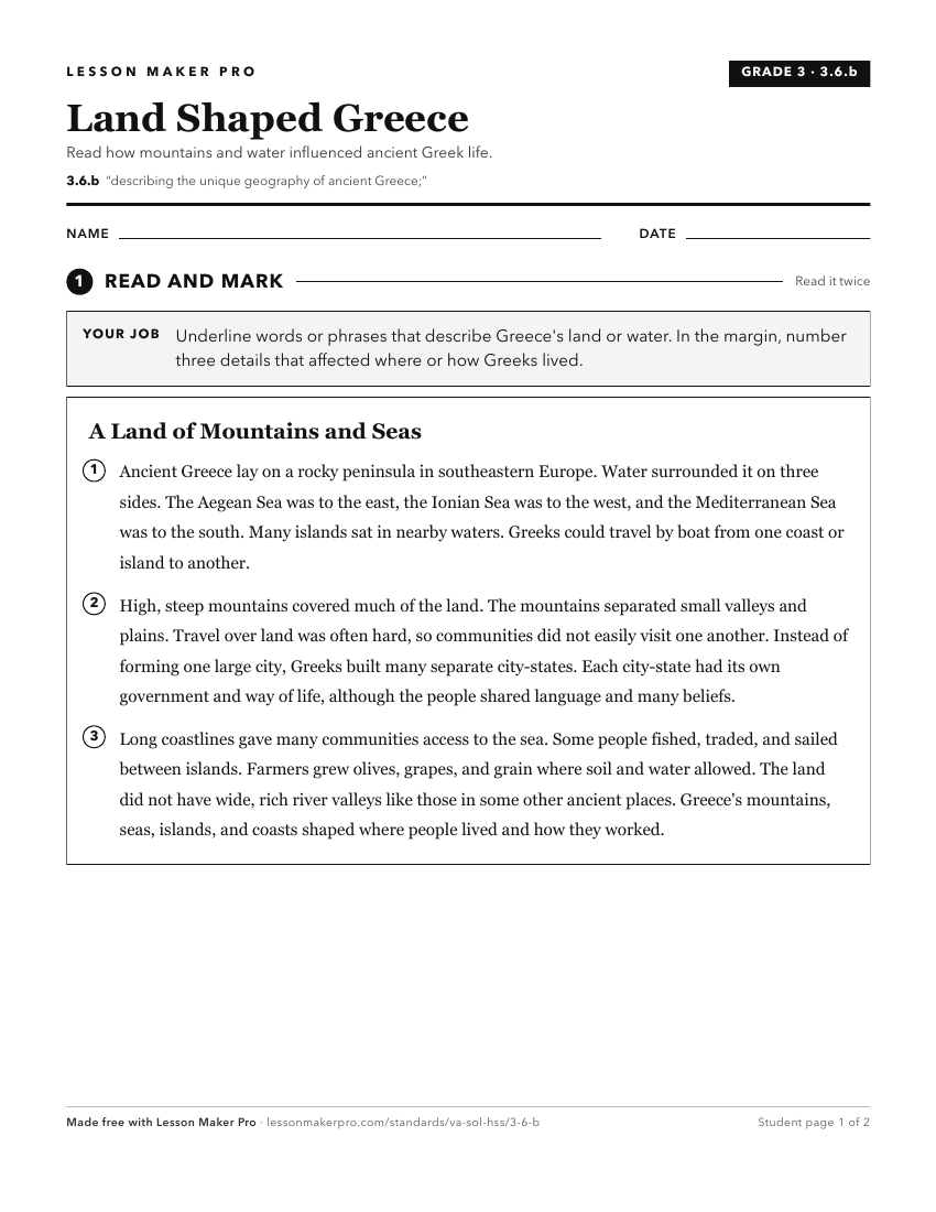
A ready-to-print activity worksheet aligned to 3.6.b, with an answer key for the teacher on its own page. No account needed.
PDF, US Letter, prints cleanly in black and white.
Download the worksheetKeep exploring
Related Standards
- WG.10.b
describing major physical and environmental features and how geography may change over time
- 3.6.a
locating ancient Greece on a map of the world
- WG.9.b
describing major physical and environmental features and how geography may change over time
- WG.5.b
describing major physical and environmental features and how geography may change over time
Turn this exact standard into a lesson
Grade, subject, topic, and the complete standard are prefilled. Create one free, no account needed.
Also for this standard:Make a WorksheetMake a QuizMake a Sub Lesson