Texas TEKS 6.20.A
The Standard
- 6.20
- The student uses geographic tools to collect, analyze, and interpret data
answer geographic questions, including: Where is it located? Why is it there? What is significant about its location? How is its location related to the location of other people, places, and environments? Using latitude and longitude, where is it located?
Texas Essential Knowledge and Skills for Social Studies
Teacher's field guide
What This Standard Means
What Students Need to Do
- Students use maps and coordinates to locate places precisely and describe their positions relative to other features. They explain how landforms, water, resources, routes, and nearby populations shape a location.
What Mastery Looks Like
- Given an unfamiliar map, students identify a place using latitude, longitude, hemispheres, and relative location. They support claims about the location with specific map evidence.
Common Misconceptions
- Students often reverse latitude and longitude, omit compass directions, or confuse hemispheres. They may use vague words like "near" without evidence or assume one geographic feature explains every location.
How to Assess It
- Give students a physical map of Egypt and ask: "Locate Cairo by latitude and longitude, then explain two advantages of its location using map evidence."
Lesson moves
Ways to Teach It
Students stretch string across a wall map to mark assigned coordinates, pin each location, and add a note explaining why settlement developed there.
Discuss: Why did Cairo grow near the Nile, and how does its position connect it to nearby regions?
Play a coordinate relay where teams draw cards, locate points on a map, and earn a bonus for naming a nearby feature.
Students choose a site for a new clinic on a local map and justify it using roads, neighborhoods, hazards, and coordinates.
Free download
Printable 6.20.A Worksheet
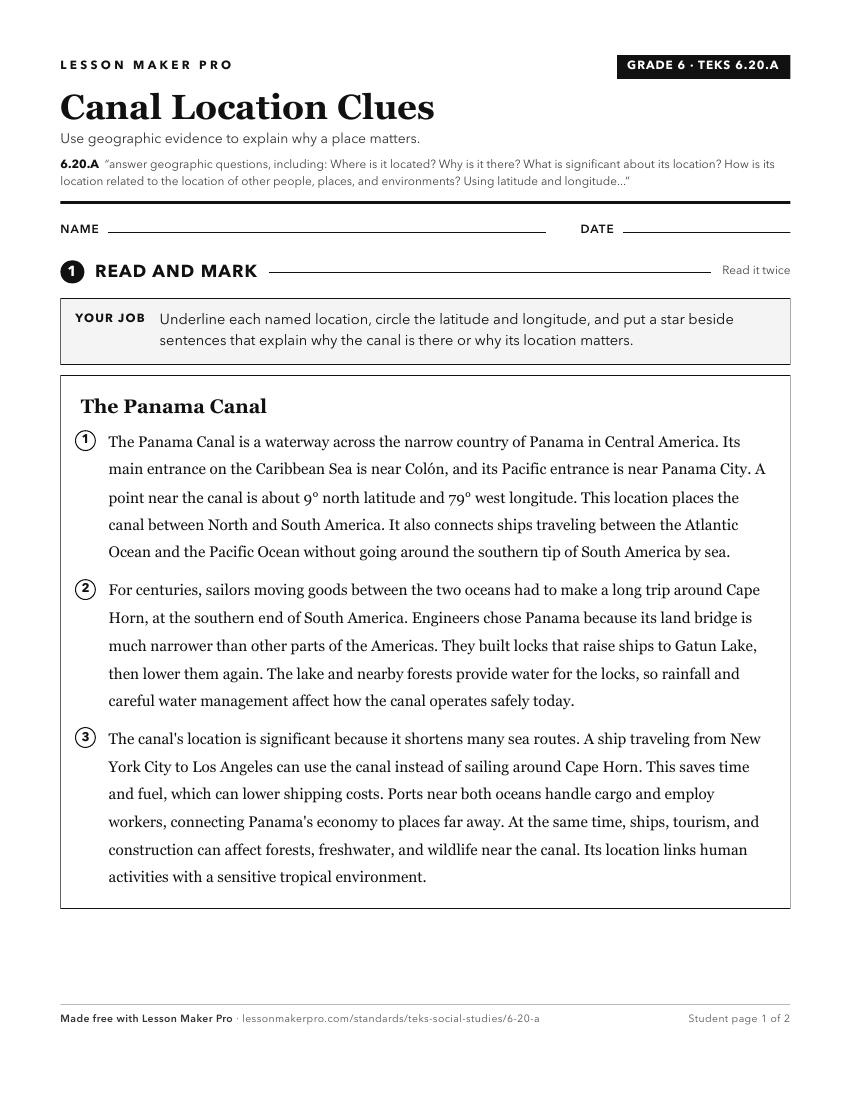
A ready-to-print activity worksheet aligned to 6.20.A, with an answer key for the teacher on its own page. No account needed.
PDF, US Letter, prints cleanly in black and white.
Download the worksheetKeep exploring
Related Standards
- 5.7
Geography. The student understands the location and patterns of settlement and the geographic factors that influence where people live. The student is expected ...
- K.3
Geography. The student understands the concept of location. The student is expected to:
- 4.7
Geography. The student understands the location and patterns of settlement and the geographic factors that influence where people live. The student is expected ...
- K.3.C
identify and use geographic tools that aid in determining location, including maps and globes.
Turn this exact standard into a lesson
Grade, subject, topic, and the complete standard are prefilled. Create one free, no account needed.
Also for this standard:Make a WorksheetMake a QuizMake a Sub Lesson