Texas TEKS 5.24.B
The Standard
- 5.24
- Social studies skills. The student uses geographic tools to collect, analyze, and interpret data. The student is expected to:
interpret geographic data, population distribution, and natural resources into a variety of formats such as graphs and maps.
Texas Essential Knowledge and Skills for Social Studies
Teacher's field guide
What This Standard Means
What Students Need to Do
- Students turn location, population, and resource data into clear maps or graphs. They choose a useful format and explain patterns shown by the data.
What Mastery Looks Like
- Students accurately plot data and include a title, labels, units, and a legend when needed. They identify patterns and support conclusions with specific map or graph evidence.
Common Misconceptions
- Students may confuse total population with population density or ignore units and map legends. They may choose a graph that hides location patterns or plot resource symbols in incorrect places.
How to Assess It
- Give students a table showing the population and main resource of four Texas regions. Ask them to create one labeled display and write one conclusion supported by the data.
Lesson moves
Ways to Teach It
Give pairs a blank Texas map, population cards, and resource stickers, then have them build a map with a clear legend.
Show a shaded map and bar graph of the same data, then ask, “Which reveals patterns better, and what evidence supports your choice?”
Play Format Match: teams pair data cards with a map or graph template, then earn a point by explaining each choice.
Use recent county data to create a graph showing where a new school, road, or water system may be needed.
Free download
Printable 5.24.B Worksheet
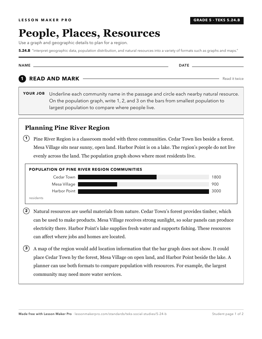
A ready-to-print activity worksheet aligned to 5.24.B, with an answer key for the teacher on its own page. No account needed.
PDF, US Letter, prints cleanly in black and white.
Download the worksheetKeep exploring
Related Standards
- 4.20.B
interpret geographic data, population distribution, and natural resources into a variety of formats such as graphs and maps.
- 6.20.D
create and interpret regional sketch maps, thematic maps, graphs, and charts depicting aspects such as population, disease, and economic activities of various w...
- 4.19.D
organize and interpret information in outlines, reports, databases, and visuals, including graphs, charts, timelines, and maps
- 8.29.H
pose and answer questions about geographic distributions and patterns shown on maps, graphs, and charts.
Turn this exact standard into a lesson
Grade, subject, topic, and the complete standard are prefilled. Create one free, no account needed.
Also for this standard:Make a WorksheetMake a QuizMake a Sub Lesson