Texas TEKS 2.3.B
The Standard
- 2.3
- Geography. The student uses simple geographic tools, including maps and globes. The student is expected to:
create maps to show places and routes within the home, school, and community.
Texas Essential Knowledge and Skills for Social Studies
Teacher's field guide
What This Standard Means
What Students Need to Do
- Students draw familiar spaces from a bird's-eye view. They use symbols, labels, and connected lines to show locations and how to travel between them.
What Mastery Looks Like
- A student can make a clear map of a familiar area with key places in reasonable positions. The student can mark a route that another person can follow.
Common Misconceptions
- Students may draw buildings from the side instead of from above. They may place landmarks randomly, leave routes disconnected, or use symbols without labels or a key.
How to Assess It
- Ask students to draw a map from the classroom door to the library, including two landmarks and a line showing the route.
Lesson moves
Ways to Teach It
Arrange blocks as a classroom model, view it from above, then sketch the furniture and a route between two spots.
Ask students to write directions for a new student traveling from the school entrance to the classroom.
Give pairs route cards and a simple school map, then have them trace each route and check one another's work.
Use a local park or store as a destination, and map a safe route from a familiar community location.
Free download
Printable 2.3.B Worksheet
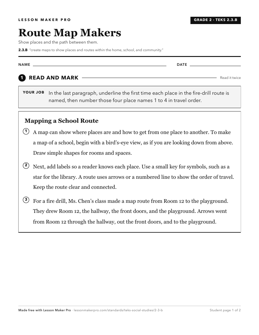
A ready-to-print activity worksheet aligned to 2.3.B, with an answer key for the teacher on its own page. No account needed.
PDF, US Letter, prints cleanly in black and white.
Download the worksheetKeep exploring
Related Standards
- K.3.B
locate places on the school campus and describe their relative locations
- 1.4.A
create and use simple maps such as maps of the home, classroom, school, and community
- 3.4.A
use cardinal and intermediate directions to locate places on maps and globes in relation to the local community
- 3.4.C
identify, create, and interpret maps of places that contain map elements, including a title, compass rose, legend, scale, and grid system.
Turn this exact standard into a lesson
Grade, subject, topic, and the complete standard are prefilled. Create one free, no account needed.
Also for this standard:Make a WorksheetMake a QuizMake a Sub Lesson