Oklahoma Social Studies WG.P.1.2
Standard Cluster
- WG.P.1
- Apply critical thinking skills to address authentic civic issues.
Develop practices which demonstrate an understanding that social studies involves the evaluation of evidence. Develop, investigate, and evaluate plausible answers to essential questions that reflect enduring understandings across time, real world circumstances, and social studies disciplines. Evaluate points of agreement and disagreement from reliable information and expert interpretations used to answer supporting questions related to content knowledge. Reinforce critical thinking by evaluating and challenging ideas and assumptions, analyzing and explaining inconsistencies in reasoning. Demonstrate understanding of content through the development of self-driven inquiries and the completion of multi-staged, authentic tasks and assessments.
Oklahoma Academic Standards for Social Studies (2026) · WG.P.1
Cluster contents
Standards in This Cluster
WG.P.1.2 is a cluster heading. These are the individual standards under it.
- WG.P.1.2.A
Develop, investigate, and evaluate plausible answers to essential questions that reflect enduring understandings across time, real world circumstances, and soci...
- WG.P.1.2.B
Evaluate points of agreement and disagreement from reliable information and expert interpretations used to answer supporting questions related to content knowle...
- WG.P.1.2.C
Reinforce critical thinking by evaluating and challenging ideas and assumptions, analyzing and explaining inconsistencies in reasoning.
- WG.P.1.2.D
Demonstrate understanding of content through the development of self-driven inquiries and the completion of multi-staged, authentic tasks and assessments.
Teacher's field guide
What This Cluster Means
What Students Need to Do
- Students ask a geographic question and use maps, data, and expert accounts to test possible answers. They check where sources agree or conflict, then revise their answer and explain the evidence behind it.
What Mastery Looks Like
- A student can compare flood risk in two coastal cities using elevation maps and flood records. They can explain why an expert's claim fits or conflicts with the data and name a limit of their evidence.
Common Misconceptions
- Students may treat a map as proof without checking its date, scale, or source. They may assume two experts disagree because one is wrong, even when the experts use different time periods or measures.
How to Assess It
- Show an elevation map of New Orleans and these claims: 'Low elevation raises flood risk' and 'Levees remove flood risk.' Ask students which claim the map supports and what evidence they would need to check the other.
Lesson moves
Ways to Teach It
Give pairs printed New Orleans elevation and levee maps; have them mark where low ground and levees overlap, then write a claim.
Ask, 'Can an elevation map prove levees make New Orleans safe?' Have students name one missing piece of evidence.
Have teams rank a dated flood map, a levee diagram, an unsigned blog post, and a flood record for testing 'Levees prevent all flooding.'
Give students a city flood-zone map and two proposed clinic sites; have them recommend one site and explain what the map cannot tell them.
Free download
Printable WG.P.1.2 Worksheet
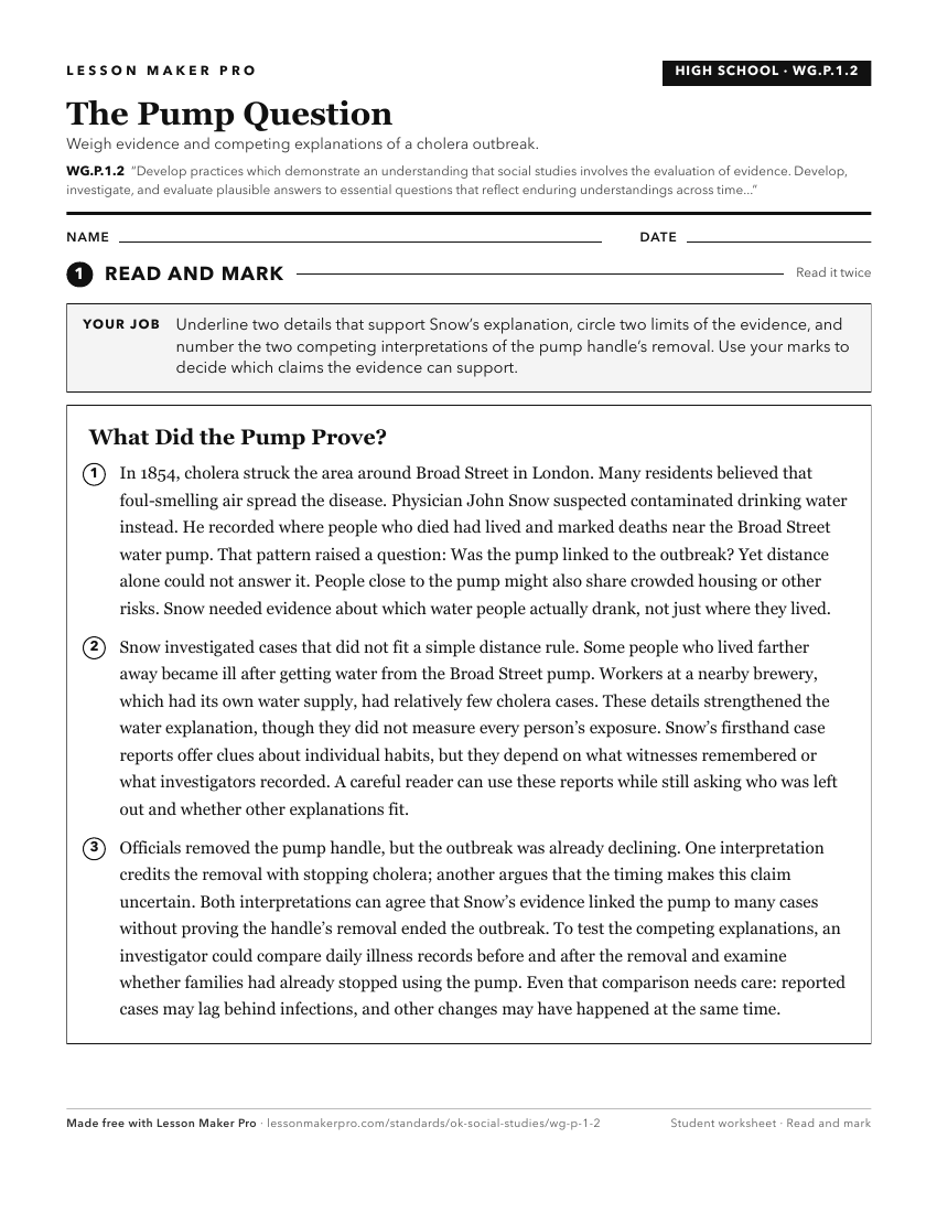
A ready-to-print activity worksheet aligned to WG.P.1.2, with an answer key for the teacher on its own page. No account needed.
PDF, US Letter, prints cleanly in black and white.
Download the worksheetKeep exploring
Related Standards
- 7.P.1.2
Develop practices which demonstrate an understanding that social studies involves the evaluation of evidence.
- 8.P.1.2
Develop practices which demonstrate an understanding that social studies involves the evaluation of evidence.
- 1.P.1.2
Develop practices which demonstrate an understanding that social studies involves the evaluation of evidence.
- 6.P.1.2
Develop practices which demonstrate an understanding that social studies involves the evaluation of evidence.
Turn this cluster into a lesson
Grade, subject, topic, and the complete cluster are prefilled. Create one free, no account needed.
Also for this cluster:Make a WorksheetMake a QuizMake a Sub Lesson