Oklahoma Social Studies WG.C.3
Standard Cluster
Analyze the components and regional variations of cultural patterns and processes. Compare the world’s major cultural landscapes to analyze cultural differences, cultural identity, social mores, and sets of beliefs which determine a sense of place. Describe and draw conclusions about the spatial dimensions of culture as defined by language, religion, and ethnicity. Analyze the role of the environment in influencing a region’s culture. Explain the processes of cultural diffusion and interdependence, analyzing their impact on defining a region.
Oklahoma Academic Standards for Social Studies (2026)
Cluster contents
Standards in This Cluster
WG.C.3 is a cluster heading. These are the individual standards under it.
- WG.C.3.1
Compare the world’s major cultural landscapes to analyze cultural differences, cultural identity, social mores, and sets of beliefs which determine a sense of p...
- WG.C.3.2
Describe and draw conclusions about the spatial dimensions of culture as defined by language, religion, and ethnicity.
- WG.C.3.3
Analyze the role of the environment in influencing a region’s culture.
- WG.C.3.4
Explain the processes of cultural diffusion and interdependence, analyzing their impact on defining a region.
Teacher's field guide
What This Cluster Means
What Students Need to Do
- Students compare maps and photos to describe how language, religion, ethnicity, and customs vary within and across regions. They use evidence to explain how climate, migration, and trade shape local practices.
What Mastery Looks Like
- Students can use maps to link a port city’s languages to trade routes and a local food to climate. They can name an exception to a regional pattern and support it with evidence.
Common Misconceptions
- Students may treat a whole region as one culture or assume people who share a language also share a religion. They may claim climate determines beliefs or that borrowed customs replace local ones.
How to Assess It
- Give students language, religion, climate, and trade maps of South Asia. Ask them to identify one cultural pattern, one exception, and one possible cause supported by map evidence.
Lesson moves
Ways to Teach It
Give pairs printed language, religion, climate, and trade maps of South Asia; have them mark two overlaps and one exception.
Show market photos from Mumbai and Casablanca; ask, 'What do signs and foods suggest about identity, and what can’t these photos tell us?'
Play map-match: students pair language and religion map cards with regions, then defend each match using one visible clue.
Compare two local restaurant menus with grocery store origin labels, then map one ingredient’s path into your town.
Free download
Printable WG.C.3 Worksheet
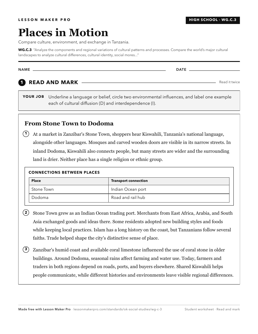
A ready-to-print activity worksheet aligned to WG.C.3, with an answer key for the teacher on its own page. No account needed.
PDF, US Letter, prints cleanly in black and white.
Download the worksheetKeep exploring
Related Standards
- WG.C.1.1
Analyze key concepts underlying the geographical perspectives of location, space, place, scale, pattern, regionalization, and globalization.
- MWH.C.1
Analyze the impact of the patterns of ancient political, economic, and cultural development.
- 7.C.5
Evaluate the development and impact of culture on the major regions and peoples of the Eastern Hemisphere.
Turn this cluster into a lesson
Grade, subject, topic, and the complete cluster are prefilled. Create one free, no account needed.
Also for this cluster:Make a WorksheetMake a QuizMake a Sub Lesson