Oklahoma Social Studies 4.C.4.2
Standard Cluster
- 4.C.4
- Examine the United States of America’s economic system and its economic activities which support human development.
Describe how economic activities impact the nation’s economy. Identify the major economic activities in which people of each region work to satisfy their needs and wants (e.g., commercial agriculture, manufacturing, energy production, construction, and services such as healthcare and technology). Distinguish between renewable (e.g., water, soil, solar) and nonrenewable resources (e.g., fossil fuels: oil, natural gas, coal) and explain how they are used to produce goods and services, using examples from regional economies. Describe the relative location and importance of natural resources which support human development in each region (e.g., Mid-Continent oilfield, Appalachian and Rocky Mountain coal basins, Ogallala Aquifer, Imperial Valley, Outer Banks).
Oklahoma Academic Standards for Social Studies (2026) · 4.C.4
Cluster contents
Standards in This Cluster
4.C.4.2 is a cluster heading. These are the individual standards under it.
- 4.C.4.2.A
Identify the major economic activities in which people of each region work to satisfy their needs and wants (e.g., commercial agriculture, manufacturing, energy...
- 4.C.4.2.B
Distinguish between renewable (e.g., water, soil, solar) and nonrenewable resources (e.g., fossil fuels: oil, natural gas, coal) and explain how they are used t...
- 4.C.4.2.C
Describe the relative location and importance of natural resources which support human development in each region (e.g., Mid-Continent oilfield, Appalachian and...
Teacher's field guide
What This Cluster Means
What Students Need to Do
- Students use a U.S. map to locate resources and the jobs tied to them. They connect farming, factories, energy production, construction, and services to goods and services used nationwide. They tell which resources can renew and which cannot.
What Mastery Looks Like
- Students locate the Ogallala Aquifer beneath the Great Plains and link its water to crops sold nationwide. They place Appalachian coal east of the Great Plains and connect it to electricity. They explain why sunlight renews but coal does not.
Common Misconceptions
- Some students leave out healthcare and technology because those jobs do not always make physical goods. Others call oil renewable because people can keep drilling for it. They may think aquifer water refills as fast as farms use it.
How to Assess It
- On a blank U.S. map, label the Ogallala Aquifer and Appalachian coal region. For each, name a job it supports, say whether the resource can renew, and explain how it helps people in other regions.
Lesson moves
Ways to Teach It
Give pairs a U.S. map and cards for Ogallala water, Mid-Continent oil, Appalachian coal, and Imperial Valley farms; place them and match job cards.
Ask: If North Carolina's Outer Banks beaches shrank, how could that affect hotels and suppliers in other states?
Race to sort soil, sunlight, water, coal, gas, and oil cards by renewability; explain why Ogallala water can still run low.
Trace a loaf of bread from Great Plains wheat farms through a mill, a truck company, and a local grocery store; list the jobs.
Free download
Printable 4.C.4.2 Worksheet
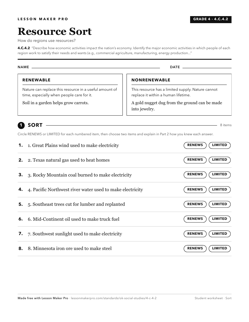
A ready-to-print activity worksheet aligned to 4.C.4.2, with an answer key for the teacher on its own page. No account needed.
PDF, US Letter, prints cleanly in black and white.
Download the worksheetKeep exploring
Related Standards
- 3.C.4
Identify and describe basic economic activities creating prosperity for the state.
- USG.C.1.5
Examine the role of government in a nation’s economy.
- 6.C.6.2.B
Describe how government policies affect economic activities within a nation, as well as determine trade relationships.
- 6.C.6.3
Explain how different sectors of a nation’s economy contribute to the development of a nation.
Turn this cluster into a lesson
Grade, subject, topic, and the complete cluster are prefilled. Create one free, no account needed.
Also for this cluster:Make a WorksheetMake a QuizMake a Sub Lesson