Mississippi Science MAQ.2.3
The Standard
- MAQ.2
- Students will develop an understanding of the principles of fluid dynamics as it relates to both salt and freshwater systems.
Summarize principles related to currents (e.g., global wind patterns, Coriolis effect, Ekman spiral, surface, thermohaline, upwelling, downwelling, El Niño, La Niña, hurricanes, Barrier Island movement).
2026 Mississippi College- and Career-Readiness Standards for Science · Fluid Dynamics
Teacher's field guide
What This Standard Means
What Students Need to Do
- Students show how wind and Earth's rotation move surface water, including how its direction changes with depth. They explain how temperature and salt affect deep currents and how shifting winds change upwelling during El Niño and La Niña. They link currents and hurricane waves to barrier island movement.
What Mastery Looks Like
- On a Northern Hemisphere coast map, a student draws net water transport to the right of the wind and identifies where upwelling will occur. They explain why cold, salty water sinks and how weaker trade winds reduce upwelling off South America.
Common Misconceptions
- Students may draw water moving straight with the wind at every depth. They may think upwelling brings warm water up or that Earth's rotation bends currents right in both hemispheres. Some treat El Niño as a hot day rather than a shift in Pacific winds and water.
How to Assess It
- On an exit ticket, show a Northern Hemisphere west coast with wind blowing south. Ask students to draw net surface water transport and explain whether upwelling or downwelling occurs.
Lesson moves
Ways to Teach It
Pour cold, salty blue water into one end of a clear tray of warm fresh water; have students sketch where the blue water moves.
On a Pacific map, ask students to write two sentences explaining how weaker trade winds change upwelling off South America during El Niño.
Give pairs cards labeled wind, Coriolis, Ekman transport, upwelling, and downwelling; have them arrange cause-and-effect chains and explain each link.
Compare before-and-after photos of a barrier island after a hurricane; circle new sand deposits and mark where the shoreline retreated.
Free download
Printable MAQ.2.3 Worksheet
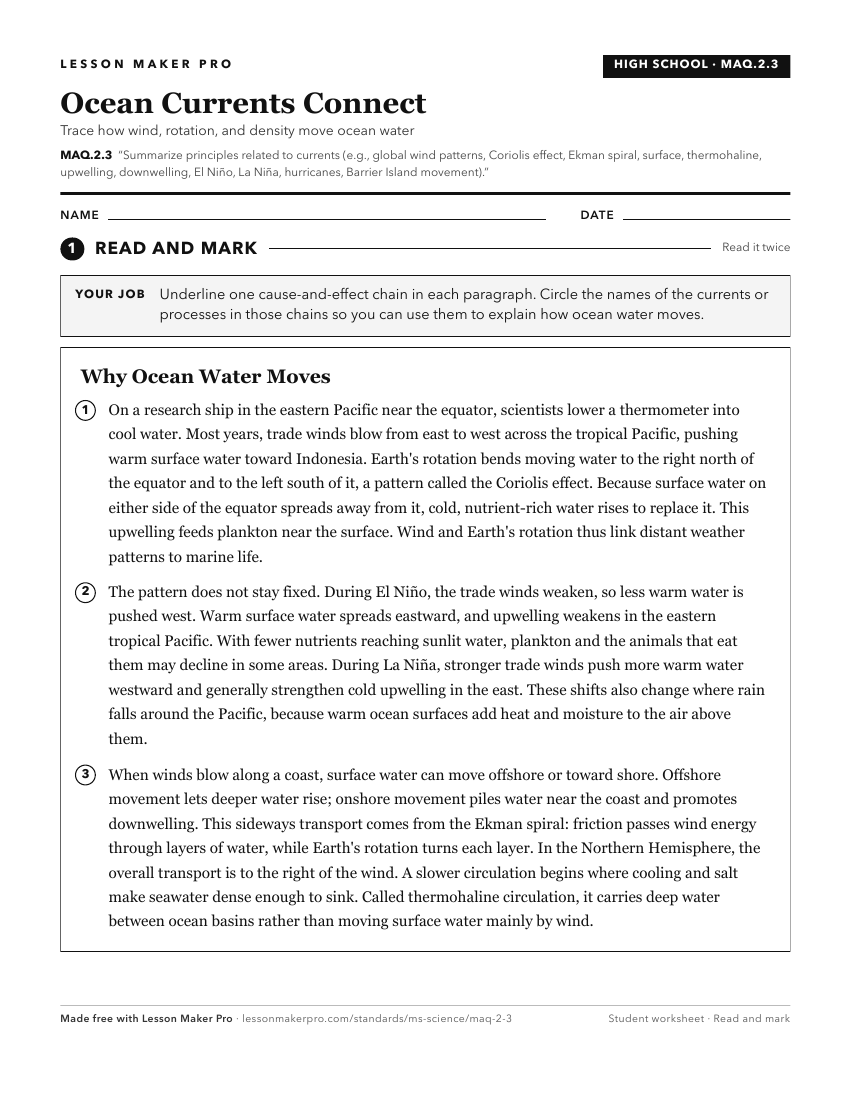
A ready-to-print activity worksheet aligned to MAQ.2.3, with an answer key for the teacher on its own page. No account needed.
PDF, US Letter, prints cleanly in black and white.
Download the worksheetKeep exploring
Related Standards
- E.7.9A
Students will demonstrate an understanding of how complex changes in the movement and patterns of air and water molecules caused by the sun, winds, landforms, o...
- E.4.9C.2
Develop and use models of natural processes to explain the effect of the movement of water on the ocean shore zone, including beaches, barrier islands, estuarie...
- E.7.9A.4
Construct an explanation for how climate is determined in an area using global and surface features (e.g. latitude, elevation, shape of the land, distance from ...
- E.7.9A.2
Analyze evidence to explain the weather conditions that result from the relationship between the movement of water and air masses.
Turn this exact standard into a lesson
Grade, subject, topic, and the complete standard are prefilled. Create one free, no account needed.
Also for this standard:Make a WorksheetMake a QuizMake a Sub Lesson