Mississippi Science E.7.9A.4
The Standard
- E.7.9A
- Students will demonstrate an understanding of how complex changes in the movement and patterns of air and water molecules caused by the sun, winds, landforms, ocean temperatures, and currents in the atmosphere are major determinants of local and global weather patterns.
Construct an explanation for how climate is determined in an area using global and surface features (e.g., latitude, elevation, shape of the land, distance from water, global winds, and ocean currents).
2026 Mississippi College- and Career-Readiness Standards for Science · Earth’s Systems and Cycles
Teacher's field guide
What This Standard Means
What Students Need to Do
- Students explain a place’s usual temperature and rainfall using maps. They connect those patterns to latitude, elevation, mountains, distance from water, winds, and ocean currents.
What Mastery Looks Like
- Given two locations, students predict which is warmer or wetter and name the features behind each difference. They can explain why places at the same latitude may have different climates.
Common Misconceptions
- Students may confuse today’s weather with climate. They may assume places at the same latitude have the same climate. They may think mountains affect only temperature, overlooking the difference in rainfall on each side.
How to Assess It
- Exit ticket: Winds blow from the ocean over coastal Town A, then across mountains to inland Town B. Which town is likely wetter, and which has milder temperatures? Explain both answers.
Lesson moves
Ways to Teach It
Use a lamp and globe to compare the angle of sunlight at the equator and high latitudes; sketch where the light spreads out.
Show a map of the Cascades with west-to-east wind arrows and ask, “Why does the west slope get more rain?”
Use North America climate and physical maps to rank Seattle, Denver, and Phoenix by annual rainfall; have partners defend their rankings.
Compare January temperatures in London and Calgary on a chart; use an ocean-current map to discuss the role of water and winds.
Free download
Printable E.7.9A.4 Worksheet
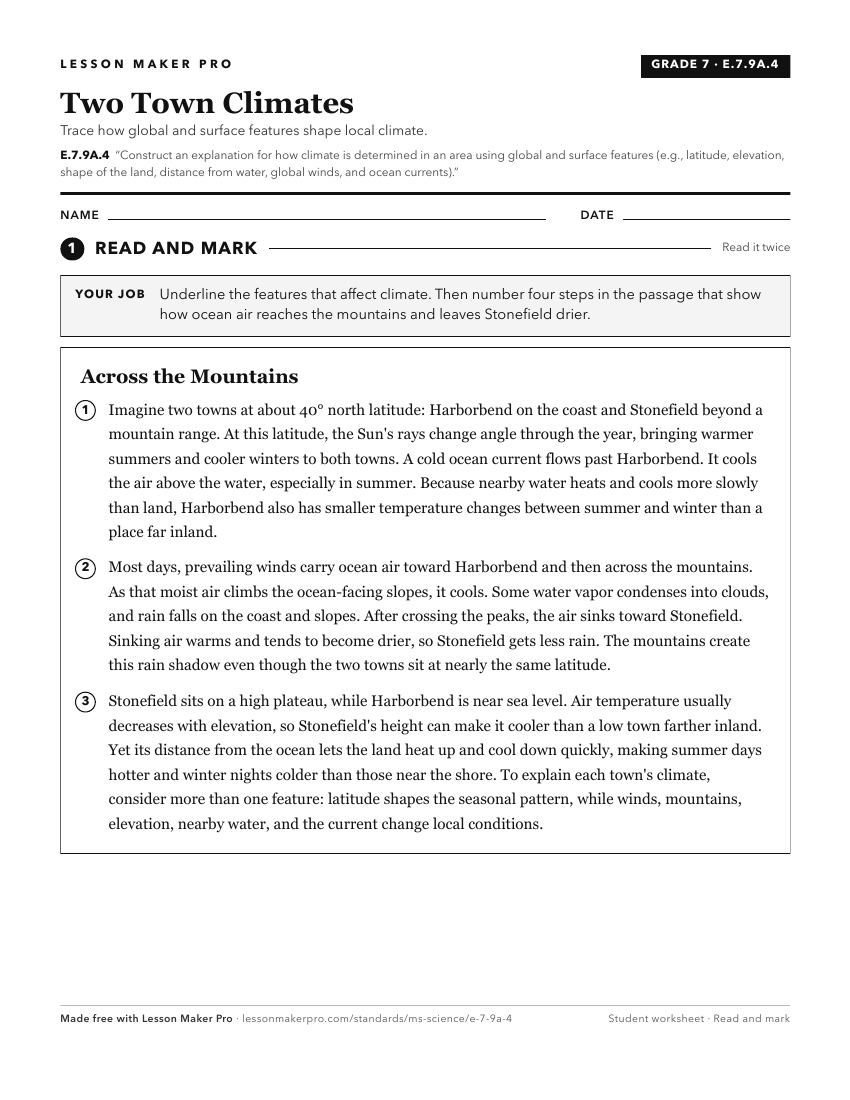
A ready-to-print activity worksheet aligned to E.7.9A.4, with an answer key for the teacher on its own page. No account needed.
PDF, US Letter, prints cleanly in black and white.
Download the worksheetKeep exploring
Related Standards
- E.K.8A.1
Construct an explanation of the pattern of the Earth's seasonal changes in the environment using evidence from observations.
- E.4.9B.2
Construct explanations about regional climate differences using maps and long-term data from various regions.
- ESS.3.6
Construct an explanation from data sets to obtain and evaluate scientific information to construct scientific arguments on changes in climate caused by various ...
- E.3.9.2
Construct explanations of how different landforms and surface features result from the location and movement of water on Earth’s surface (e.g., watersheds, drai...
Turn this exact standard into a lesson
Grade, subject, topic, and the complete standard are prefilled. Create one free, no account needed.
Also for this standard:Make a WorksheetMake a QuizMake a Sub Lesson