Mississippi Science E.7.9A.6
The Standard
- E.7.9A
- Students will demonstrate an understanding of how complex changes in the movement and patterns of air and water molecules caused by the sun, winds, landforms, ocean temperatures, and currents in the atmosphere are major determinants of local and global weather patterns.
Research and use models to explain what type of weather (thunderstorms, hurricanes, and tornadoes) results from the movement and interactions of air masses, high- and low-pressure systems, and frontal boundaries.
2026 Mississippi College- and Career-Readiness Standards for Science · Earth’s Systems and Cycles
Teacher's field guide
What This Standard Means
What Students Need to Do
- Students research the conditions that produce thunderstorms, tornadoes, and hurricanes. They draw models showing how air masses, fronts, and pressure systems move air and help storms form.
What Mastery Looks Like
- A student shows air rising near a front or low-pressure area and sinking under high pressure. They link thunderstorms to rising moist air and tornadoes to rotating severe thunderstorms. They show a hurricane growing over warm ocean water around a low-pressure center, without needing a front.
Common Misconceptions
- Students may think every front brings a tornado or every thunderstorm becomes one. They may think hurricanes form where warm and cold fronts meet, or that high pressure pulls air upward.
How to Assess It
- On an exit ticket, ask students to draw a cold front, a high-pressure area, and a low-pressure area over warm ocean water. Have them add air arrows, label where a thunderstorm or hurricane might form, and explain why a tornado is not certain.
Lesson moves
Ways to Teach It
Use red and blue paper strips as air masses; slide the cold strip beneath the warm strip and draw rising-air arrows and thunderclouds.
Read NOAA's hurricane and tornado pages, then write: Why does a hurricane need warm ocean water while a tornado needs a rotating thunderstorm?
Hand out weather-map cards and storm cards; have pairs match each map to a storm and defend the match using arrows and labels.
Compare a past NOAA hurricane track with a sea-surface temperature map; mark where the storm crossed warm water.
Free download
Printable E.7.9A.6 Worksheet
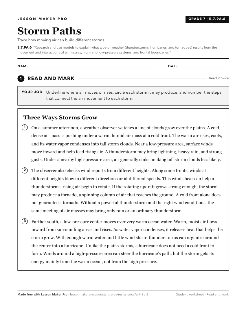
A ready-to-print activity worksheet aligned to E.7.9A.6, with an answer key for the teacher on its own page. No account needed.
PDF, US Letter, prints cleanly in black and white.
Download the worksheetKeep exploring
Related Standards
- E.1.9A.2
Develop and use models to predict weather conditions associated with seasonal patterns and changes.
- ESS.3.5
Analyze and interpret weather data using maps and global weather systems to explain and communicate the relationships among air masses, pressure systems, and fr...
- E.7.9A.5
Analyze models to explain the cause and effect relationship between solar energy and convection and the resulting weather patterns and climate conditions.
- E.7.9A.2
Analyze evidence to explain the weather conditions that result from the relationship between the movement of water and air masses.
Turn this exact standard into a lesson
Grade, subject, topic, and the complete standard are prefilled. Create one free, no account needed.
Also for this standard:Make a WorksheetMake a QuizMake a Sub Lesson