Mississippi Science ESS.3.5
The Standard
- ESS.3
- Students will develop an understanding of Earth’s systems and cycles.
Analyze and interpret weather data using maps and global weather systems to explain and communicate the relationships among air masses, pressure systems, and frontal boundaries.
2026 Mississippi College- and Career-Readiness Standards for Science · Earth’s Systems and Cycles
Teacher's field guide
What This Standard Means
What Students Need to Do
- Read weather maps for temperature, wind, pressure, and fronts. Track air masses across maps and explain how prevailing winds and pressure systems move fronts and change local weather.
What Mastery Looks Like
- Given maps from two times, students locate a high, a low, and a front. They use temperature and wind changes to identify the incoming air mass and predict likely weather.
Common Misconceptions
- Students may think a front is a line of rain, rather than a boundary between air masses. They may mistake a low-pressure center for a cold air mass.
How to Assess It
- Print a surface weather map with a marked cold front. Ask: “Circle the low-pressure center. Which side of the front has colder air? Use two map clues to predict what will change at a nearby town.”
Lesson moves
Ways to Teach It
Give pairs printed weather maps and colored pencils; have them trace a front, circle the low, and shade warm and cold air masses.
Show maps six hours apart and ask, “How did the low and front move, and what changed at the marked city?”
Play forecast swap: teams trade weather maps, predict conditions at a marked city, then check their predictions against a later map.
Use a local forecast map and prevailing-wind arrows to choose a time for an outdoor game before an approaching front arrives.
Free download
Printable ESS.3.5 Worksheet
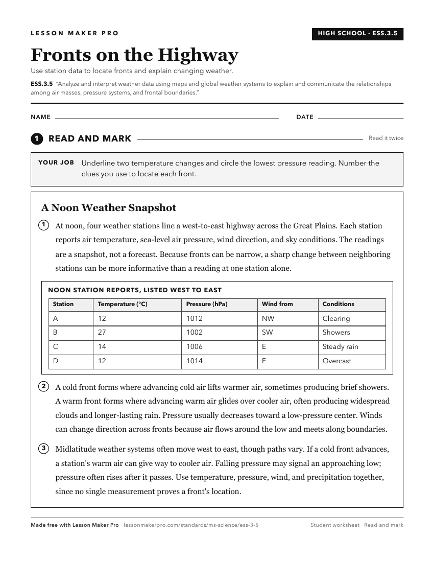
A ready-to-print activity worksheet aligned to ESS.3.5, with an answer key for the teacher on its own page. No account needed.
PDF, US Letter, prints cleanly in black and white.
Download the worksheetKeep exploring
Related Standards
- E.7.9A.1
Analyze and interpret weather patterns from various regions to differentiate between weather and climate.
- E.4.9B.1
Analyze and interpret data (e.g., temperature, precipitation, wind speed/direction, relative humidity, or cloud types) to predict changes in weather over time.
- E.7.9A.2
Analyze evidence to explain the weather conditions that result from the relationship between the movement of water and air masses.
- E.7.9A.3
Interpret atmospheric data from satellites, radar, and weather maps to predict weather patterns and conditions.
Turn this exact standard into a lesson
Grade, subject, topic, and the complete standard are prefilled. Create one free, no account needed.
Also for this standard:Make a WorksheetMake a QuizMake a Sub Lesson