Mississippi Science E.7.9A.3
The Standard
- E.7.9A
- Students will demonstrate an understanding of how complex changes in the movement and patterns of air and water molecules caused by the sun, winds, landforms, ocean temperatures, and currents in the atmosphere are major determinants of local and global weather patterns.
Interpret atmospheric data from satellites, radar, and weather maps to predict weather patterns and conditions.
2026 Mississippi College- and Career-Readiness Standards for Science · Earth’s Systems and Cycles
Teacher's field guide
What This Standard Means
What Students Need to Do
- Students read satellite images for cloud cover, radar for precipitation, and weather maps for fronts. They compare images from different times to predict what weather is headed toward a place.
What Mastery Looks Like
- A student can track a rain area across two time-stamped radar images. They can predict conditions for a marked town and point to evidence on the images and map.
Common Misconceptions
- Students may think clouds on a satellite image mean rain is falling, even when radar shows none. They may read one radar image as a forecast instead of a snapshot, or assume a front will stay put.
How to Assess It
- Show two hourly radar images, a satellite image, and a weather map with a marked town. Ask: "Will this town get rain in the next few hours? Use evidence from two sources."
Lesson moves
Ways to Teach It
Give pairs two hourly radar printouts and a weather map; have them draw arrows showing rain movement and circle towns likely to get wet.
Show a cloudy satellite image beside radar with no rain; ask, "Would you pack an umbrella? What does each image tell you?"
Play forecast match: give pairs three town cards and a map with radar images; match each town to a rain or dry forecast.
Before recess, check a local radar loop and weather map; have students recommend indoor or outdoor recess and explain their choice.
Free download
Printable E.7.9A.3 Worksheet
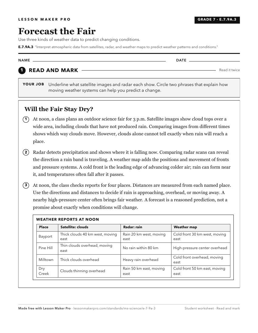
A ready-to-print activity worksheet aligned to E.7.9A.3, with an answer key for the teacher on its own page. No account needed.
PDF, US Letter, prints cleanly in black and white.
Download the worksheetKeep exploring
Related Standards
- E.1.9A.1
Analyze and interpret data from observations and measurements to describe local weather conditions (including temperature, wind, and forms of precipitation).
- E.1.9A.2
Develop and use models to predict weather conditions associated with seasonal patterns and changes.
- ESS.3.5
Analyze and interpret weather data using maps and global weather systems to explain and communicate the relationships among air masses, pressure systems, and fr...
- E.4.9B.1
Analyze and interpret data (e.g., temperature, precipitation, wind speed/direction, relative humidity, or cloud types) to predict changes in weather over time.
Turn this exact standard into a lesson
Grade, subject, topic, and the complete standard are prefilled. Create one free, no account needed.
Also for this standard:Make a WorksheetMake a QuizMake a Sub Lesson