Indiana Social Studies WG.4.15
The Standard
Describe and explain the worldwide trend toward urbanization and be able to graph the trend.
2026 Indiana Academic Standards: K-12 Social Studies · Human Settlement
Teacher's field guide
What This Standard Means
What Students Need to Do
- Students graph the share of the world's population living in cities over time. They describe the increase and explain it using migration, city population growth, and the spread of built-up areas.
What Mastery Looks Like
- A student labels time and percent on the correct axes and plots the data accurately. They explain that the urban share rose, not just the number of city residents, and give a reason for the change.
Common Misconceptions
- Students may graph the number of city residents when the data shows a percentage. Some think urban growth happens only when people move from farms to cities. Others assume every country is urbanizing at the same rate.
How to Assess It
- Give students two data points: 30% of the world lived in urban areas in 1950 and 56% in 2020. Ask them to plot both points, describe the change, and name one reason for it.
Lesson moves
Ways to Teach It
Give pairs a data strip for 1950, 2000, and 2020, then have them draw a line graph with labeled axes.
Ask students to write why a farm family might move to a city and how a city could grow without newcomers.
Read three city-growth scenarios; have groups hold up cards labeled migration, births, or boundary expansion.
Compare two dated images of a nearby city in Google Earth Timelapse, then circle land that changed from fields to buildings.
Free download
Printable WG.4.15 Worksheet
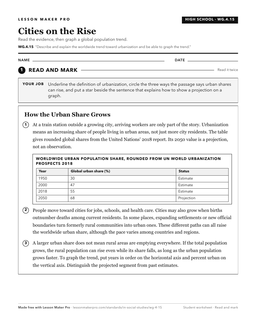
A ready-to-print activity worksheet aligned to WG.4.15, with an answer key for the teacher on its own page. No account needed.
PDF, US Letter, prints cleanly in black and white.
Download the worksheetKeep exploring
Related Standards
- GHW.5.2
Describe, using a variety of texts (writing, maps, timelines, and/or other graphic representations), the worldwide trend toward urbanization and the changing fu...
- 7.G.7
Identify current trends and patterns of rural and urban population distribution in selected countries of Africa, Asia, and the Southwest Pacific, and analyze th...
- GHW.3.1
Map and analyze the distribution of the world's human population for different time periods, noting the population characteristics and population density for sp...
- WG.4.1
Using maps, establish world patterns of population distribution, density, and growth. Relate population growth rates to health statistics, food supply, or measu...
Turn this exact standard into a lesson
Grade, subject, topic, and the complete standard are prefilled. Create one free, no account needed.
Also for this standard:Make a WorksheetMake a QuizMake a Sub Lesson