Indiana Social Studies 7.G.7
The Standard
Identify current trends and patterns of rural and urban population distribution in selected countries of Africa, Asia, and the Southwest Pacific, and analyze the causes for these patterns.
2026 Indiana Academic Standards: K-12 Social Studies
Teacher's field guide
What This Standard Means
What Students Need to Do
- Students use maps and population data to see where people live in countries such as Nigeria, Japan, and Australia. They compare city and rural populations and explain how jobs, water, climate, and landforms shape those patterns.
What Mastery Looks Like
- A student can locate Lagos, Tokyo, and Australia's populated coast on a map. They can compare urban and rural population shares and explain why jobs draw people to Lagos or why Australia's dry interior has fewer residents.
Common Misconceptions
- Students may assume every African country is mostly rural or that a large rural land area means most people live there. They may treat climate as the only cause and overlook jobs and transport.
How to Assess It
- Show labeled population density maps of Nigeria, Japan, and Australia. Ask students to compare city and rural settlement in two countries and explain one cause of each country's pattern.
Lesson moves
Ways to Teach It
Give pairs printed population maps of Nigeria, Japan, and Australia; have them place stickers on major cities and shade sparsely settled areas.
Ask: Why do many people live near Tokyo and Sydney, while Japan's mountains and Australia's interior have fewer residents?
Play a card sort: match Lagos's growth, Tokyo's dense metro area, and Australia's sparse interior with jobs, transport, and dry climate.
Compare Sydney and Alice Springs on a map; have students list nearby towns and write how climate affects settlement.
Free download
Printable 7.G.7 Worksheet
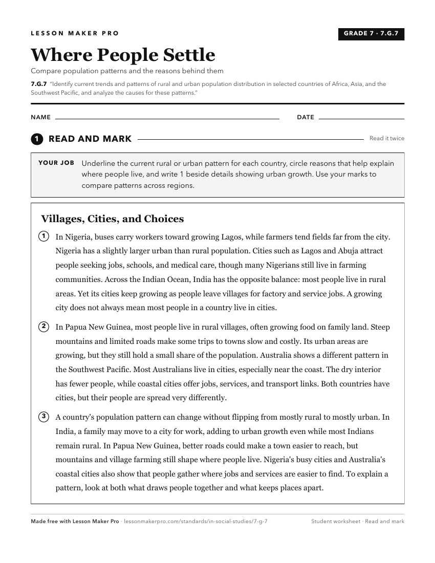
A ready-to-print activity worksheet aligned to 7.G.7, with an answer key for the teacher on its own page. No account needed.
PDF, US Letter, prints cleanly in black and white.
Download the worksheetKeep exploring
Related Standards
- GHW.3.3
Analyze the changes in population characteristics and physical and human environments that resulted from the migration of peoples within, between, and among wor...
- 7.G.9
Analyze current issues and developments related to the environment in selected countries in Africa, Asia, and the Southwest Pacific.
- GHW.3.1
Map and analyze the distribution of the world's human population for different time periods, noting the population characteristics and population density for sp...
- WG.4.1
Using maps, establish world patterns of population distribution, density, and growth. Relate population growth rates to health statistics, food supply, or measu...
Turn this exact standard into a lesson
Grade, subject, topic, and the complete standard are prefilled. Create one free, no account needed.
Also for this standard:Make a WorksheetMake a QuizMake a Sub Lesson