Indiana Social Studies WG.4.13
The Standard
Identify contemporary spatial patterns in the movement of goods, services, and ideas throughout the world.
2026 Indiana Academic Standards: K-12 Social Studies · Economic Interdependence (Globalization)
Teacher's field guide
What This Standard Means
What Students Need to Do
- Students use maps to trace where goods are shipped, services are provided, and ideas spread across borders. They identify busy routes, hubs, and places with fewer connections.
What Mastery Looks Like
- A student can map phones shipped from China to the United States and support calls handled in India for US customers. They can show where a video idea spreads online and use the map to point out a shared destination.
Common Misconceptions
- Students may assume a product was made in the country where it was sold. They may think services cannot cross borders or that an online idea reaches every country equally.
How to Assess It
- Give students a blank world map and three cards: phones shipped from China to the US, support calls from India to the US, and a video posted in South Korea and viewed in the US. Ask them to draw labeled arrows and name one pattern they see.
Lesson moves
Ways to Teach It
Use colored yarn and pins on a wall map to trace a phone shipment, a support call, and a video shared across borders.
Ask: Why does a phone shipment need a port, while a support call from India to the US does not?
Give pairs flow cards to sort as goods, services, or ideas, then have them place origin and destination stickers on a map.
Check tags on three classroom items, map where they were made, and compare those routes with the origin of a streamed song.
Free download
Printable WG.4.13 Worksheet
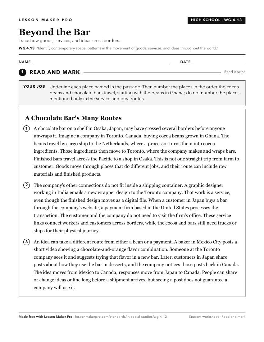
A ready-to-print activity worksheet aligned to WG.4.13, with an answer key for the teacher on its own page. No account needed.
PDF, US Letter, prints cleanly in black and white.
Download the worksheetKeep exploring
Related Standards
- WG.4.19
Identify and report on the impact of international networks and organizations that connect countries and influence of places, countries, and regions.
- GHW.8.1
Use maps to show the location and distribution of Earth’s resources, and analyze how this distribution changes over time and affects trade among countries, regi...
- GHW.8.2
Prepare graphic representations, such as maps, tables, and timelines, to describe the global movement of goods and services between and among countries and worl...
- WG.4.14
Use global political, economic, cultural, or social flows to describe and illustrate interdependence between places, countries and regions.
Turn this exact standard into a lesson
Grade, subject, topic, and the complete standard are prefilled. Create one free, no account needed.
Also for this standard:Make a WorksheetMake a QuizMake a Sub Lesson