Indiana Social Studies GHW.9.1
The Standard
Use maps to identify regions in the world where particular natural disasters occur frequently, and analyze how the physical and human environments have been modified over time in response to environmental threats. Assess the success of international aid to these disasters.
2026 Indiana Academic Standards: K-12 Social Studies
Teacher's field guide
What This Standard Means
What Students Need to Do
- Use maps to find places hit often by earthquakes, floods, or cyclones. Compare older and newer maps or photos to see how shorelines, buildings, and evacuation plans changed. Use recovery data to judge whether international aid helped.
What Mastery Looks Like
- A student finds the Bay of Bengal on a cyclone-frequency map. They explain how mangrove planting and cyclone shelters changed the coast over time. They use homes rebuilt or families reached, rather than money pledged, to judge aid.
Common Misconceptions
- Students may treat one major storm as proof that storms happen often in a region. They may mistake money pledged for help delivered, or assume a new shelter means everyone can reach safety.
How to Assess It
- On a cyclone-frequency map, circle the Bay of Bengal. Name one shoreline change and one shelter or evacuation change, then name a result that would show whether international aid helped.
Lesson moves
Ways to Teach It
Give pairs tracing paper and a Bangladesh cyclone-track map; have them sketch a mangrove belt and two shelter sites along the coast.
Ask students to write: Would rebuilt homes or restored mangroves better protect a coastal village, and what evidence supports your answer?
Run a map sort: pairs match earthquake, cyclone, and flood cards to Indonesia, Bangladesh, and Pakistan using printed frequency maps.
Print a recent Red Cross cyclone update; students underline aid delivered and recovery results, then flag one gap between help and need.
Free download
Printable GHW.9.1 Worksheet
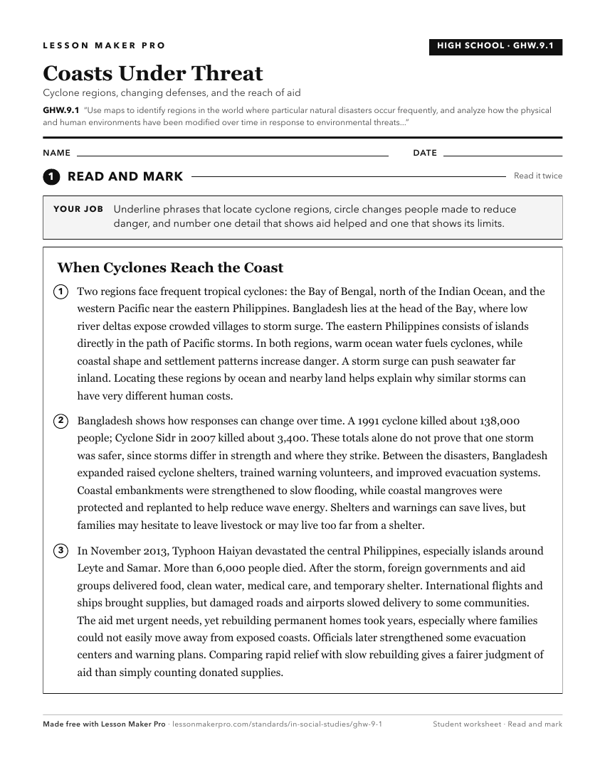
A ready-to-print activity worksheet aligned to GHW.9.1, with an answer key for the teacher on its own page. No account needed.
PDF, US Letter, prints cleanly in black and white.
Download the worksheetKeep exploring
Related Standards
- 7.G.3
Use historical and modern maps to identify changes in Africa, Asia, and the Southwest Pacific over time, highlighting physical and human systems.
- WG.5.1
Map the occurrence and describe the effects of natural hazards throughout the world and explain ways to prepare for and respond to them.
- GHW.8.1
Use maps to show the location and distribution of Earth’s resources, and analyze how this distribution changes over time and affects trade among countries, regi...
- WG.5.2
Analyze the possible effect of a natural disaster on the local community and devise plans to prepare for and respond to a disaster so as to minimize or mitigate...
Turn this exact standard into a lesson
Grade, subject, topic, and the complete standard are prefilled. Create one free, no account needed.
Also for this standard:Make a WorksheetMake a QuizMake a Sub Lesson