Indiana Social Studies 7.G.3
The Standard
Use historical and modern maps to identify changes in Africa, Asia, and the Southwest Pacific over time, highlighting physical and human systems.
2026 Indiana Academic Standards: K-12 Social Studies
Teacher's field guide
What This Standard Means
What Students Need to Do
- Students compare dated maps of Africa, Asia, and the Southwest Pacific. They identify changes in borders and settlements, then use rivers, mountains, or coastlines to help explain what they see.
What Mastery Looks Like
- Students point to one mapped change in each region and support it with dates and symbols from the maps. They explain how a river, mountain range, or coast relates to a city or travel route.
Common Misconceptions
- Students may mistake a new country name for a change in the land itself. They may overlook map dates or assume that the same symbol means the same thing on different maps.
How to Assess It
- Give students 1914 and current maps of Africa showing borders, rivers, and Cairo. Ask them to mark Sudan's border change and explain why Cairo is near the Nile.
Lesson moves
Ways to Teach It
Place tracing paper over paired maps of Africa, Asia, and the Southwest Pacific; trace borders in two colors and circle rivers or islands.
Using two dated maps of South Asia, write two sentences explaining a changed border and the Himalayas' unchanged location.
Give pairs dated map cards from all three regions; have them sort the cards by region and date, then check one change using the keys.
Compare 1970s and current maps of Port Moresby; circle new roads near the harbor and explain why the harbor drew development.
Free download
Printable 7.G.3 Worksheet
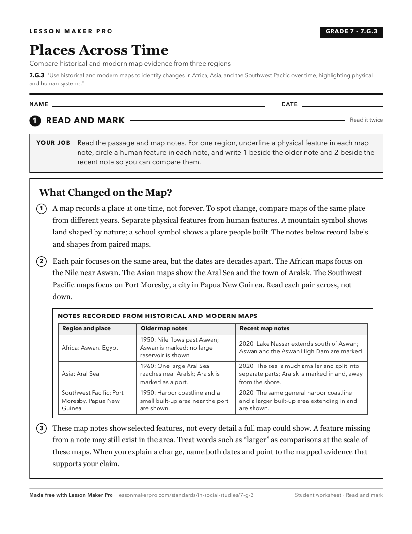
A ready-to-print activity worksheet aligned to 7.G.3, with an answer key for the teacher on its own page. No account needed.
PDF, US Letter, prints cleanly in black and white.
Download the worksheetKeep exploring
Related Standards
- WG.4.2
Develop maps of human migration and settlement patterns at different times in history and compare them to the present.
- 8.G.4
Using maps, identify changes influenced by growth, economic development, and human migration in the United States.
- 7.C.2
Compare and contrast historical and contemporary governments in Africa, Asia, and the Southwest Pacific.
- GHW.1.1
Use maps, timelines, and other graphic representations to identify and describe the location, distribution, and main events in the development of culture hearth...
Turn this exact standard into a lesson
Grade, subject, topic, and the complete standard are prefilled. Create one free, no account needed.
Also for this standard:Make a WorksheetMake a QuizMake a Sub Lesson