Indiana Social Studies GHW.1.1
The Standard
Use maps, timelines, and other graphic representations to identify and describe the location, distribution, and main events in the development of culture hearths in Asia, Mesoamerica, and North Africa.
2026 Indiana Academic Standards: K-12 Social Studies
Teacher's field guide
What This Standard Means
What Students Need to Do
- Students find early culture hearths in Asia, Mesoamerica, and North Africa on maps. They use timelines to match places with developments such as farming, cities, and states.
What Mastery Looks Like
- A student can locate Mesopotamia, the Indus Valley, the Yellow River region, the Nile Valley, and the Olmec Gulf Coast on a blank map. They can put dated events in order and match each event to its place.
Common Misconceptions
- Students may place Mesopotamia in Africa because it is near Egypt, or mistake Mesoamerica for South America. They may assume cities and states developed at the same time in every region.
How to Assess It
- Give students a blank map and three shuffled cards: Olmec centers (c. 1200 BCE), Sumerian cities (c. 3500 BCE), and Egyptian unification (c. 3100 BCE). Ask them to mark each location, order the cards, and name a nearby geographic feature.
Lesson moves
Ways to Teach It
Give pairs blank maps of Asia, North Africa, and Mesoamerica; have them shade Mesopotamia, the Nile Valley, and the Olmec Gulf Coast.
Ask students to write: Why did cities grow along the Tigris, Euphrates, and Nile, and what can a map not tell us?
Hand teams dated event cards for five hearths; have them race to place each card on a classroom timeline and map.
Open a current map of Iraq, Egypt, and Mexico; have students find the Tigris, Nile, and Veracruz near ancient hearths.
Free download
Printable GHW.1.1 Worksheet
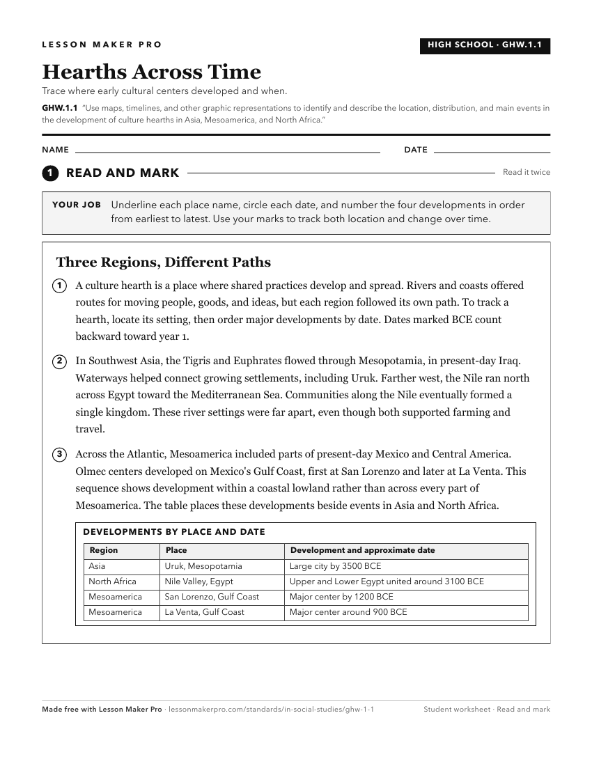
A ready-to-print activity worksheet aligned to GHW.1.1, with an answer key for the teacher on its own page. No account needed.
PDF, US Letter, prints cleanly in black and white.
Download the worksheetKeep exploring
Related Standards
- 7.G.3
Use historical and modern maps to identify changes in Africa, Asia, and the Southwest Pacific over time, highlighting physical and human systems.
- WG.4.2
Develop maps of human migration and settlement patterns at different times in history and compare them to the present.
- 6.H.5
Identify trade routes and discuss their impact on the rise of cultural centers and trade cities in Europe and Mesoamerica.
- GHW.1.2
Analyze agricultural hearths and exchanges of crops among regions. Evaluate the impact of agriculture on the subsequent development of cultural hearths in vario...
Turn this exact standard into a lesson
Grade, subject, topic, and the complete standard are prefilled. Create one free, no account needed.
Also for this standard:Make a WorksheetMake a QuizMake a Sub Lesson