Indiana Social Studies 8.G.3
The Standard
Identify the agricultural regions of the United States. Give explanations for how the land was used and developed during the growth of the United States.
2026 Indiana Academic Standards: K-12 Social Studies
Teacher's field guide
What This Standard Means
What Students Need to Do
- Students locate major U.S. farming regions on a map. They explain how climate, soil, water, transportation, and labor shaped farming as the country grew.
What Mastery Looks Like
- A student can place the Corn Belt, Wheat Belt, Cotton Belt, and California's Central Valley on a map. They can explain, for example, how railroads helped Plains farmers ship wheat to distant markets.
Common Misconceptions
- Students may think the same crops grow well everywhere or mix up the Corn Belt and Wheat Belt. They may overlook how land taken from Native peoples and enslaved labor shaped farming.
How to Assess It
- Give students a blank U.S. map. Ask them to label three farming regions and write two sentences explaining why farming expanded in one of them.
Lesson moves
Ways to Teach It
Place tracing paper over rainfall and soil maps; shade likely corn, wheat, and cotton areas, then compare with a crop map.
Write three sentences explaining how railroads and land taken from Native peoples changed farming on the Great Plains.
Give pairs a blank map and region cards; have them place the Corn Belt, Wheat Belt, Cotton Belt, and Central Valley.
Check the origins on a cornmeal bag, milk carton, and orange label; find each place on a farming-region map.
Free download
Printable 8.G.3 Worksheet
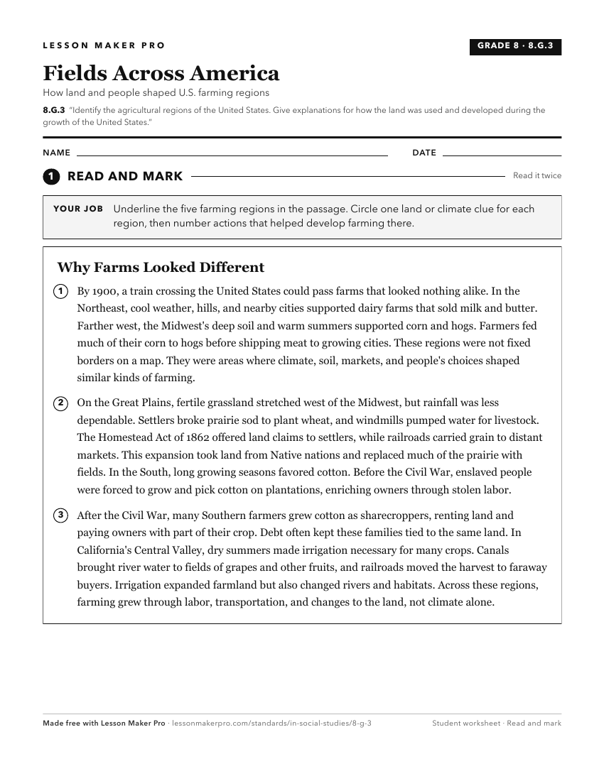
A ready-to-print activity worksheet aligned to 8.G.3, with an answer key for the teacher on its own page. No account needed.
PDF, US Letter, prints cleanly in black and white.
Download the worksheetKeep exploring
Related Standards
- 8.G.4
Using maps, identify changes influenced by growth, economic development, and human migration in the United States.
- 8.G.2
Identify the major mountain ranges and river systems of the United States and explain the importance of these physical features in the development of America.
- 8.G.7
Identify and interpret maps, graphs, and charts showing the distribution of natural resources such as forests, water sources, and wildlife in the United States ...
- 5.G.5
Identify the major manufacturing and agricultural regions in colonial America, and summarize the ways that agriculture and manufacturing changed between 1600 an...
Turn this exact standard into a lesson
Grade, subject, topic, and the complete standard are prefilled. Create one free, no account needed.
Also for this standard:Make a WorksheetMake a QuizMake a Sub Lesson