Indiana Social Studies 8.G.2
The Standard
Identify the major mountain ranges and river systems of the United States and explain the importance of these physical features in the development of America.
2026 Indiana Academic Standards: K-12 Social Studies
Teacher's field guide
What This Standard Means
What Students Need to Do
- Students locate major U.S. mountain ranges and trace river systems on a map. They explain how mountains shaped travel and settlement, and how rivers supported farming and trade.
What Mastery Looks Like
- A student can label the Appalachians, Rockies, and Sierra Nevada, and trace the Mississippi River and its Missouri and Ohio tributaries. They can explain why the Appalachians slowed westward travel and how the Mississippi helped move goods to ports.
Common Misconceptions
- Students may not realize the Missouri and Ohio feed into the Mississippi. They may think mountains blocked all travel or that boats moved upstream as easily as downstream.
How to Assess It
- Give students a blank U.S. map. Ask them to label the Appalachians and Rockies, trace the Mississippi and one tributary, and explain one way a mountain range and a river shaped settlement or trade.
Lesson moves
Ways to Teach It
On a blank U.S. map, lay blue yarn along the Mississippi, Missouri, and Ohio, then add clay ridges for the Appalachians and Rockies.
Ask: How did the Appalachians and Mississippi River shape where settlers traveled? Have students point to map evidence before writing two sentences.
Play map bingo with cards showing rivers and mountain ranges; call out location clues instead of names.
Give students a Mississippi barge route map. Have them trace grain from St. Louis to New Orleans and explain why the river still matters.
Free download
Printable 8.G.2 Worksheet
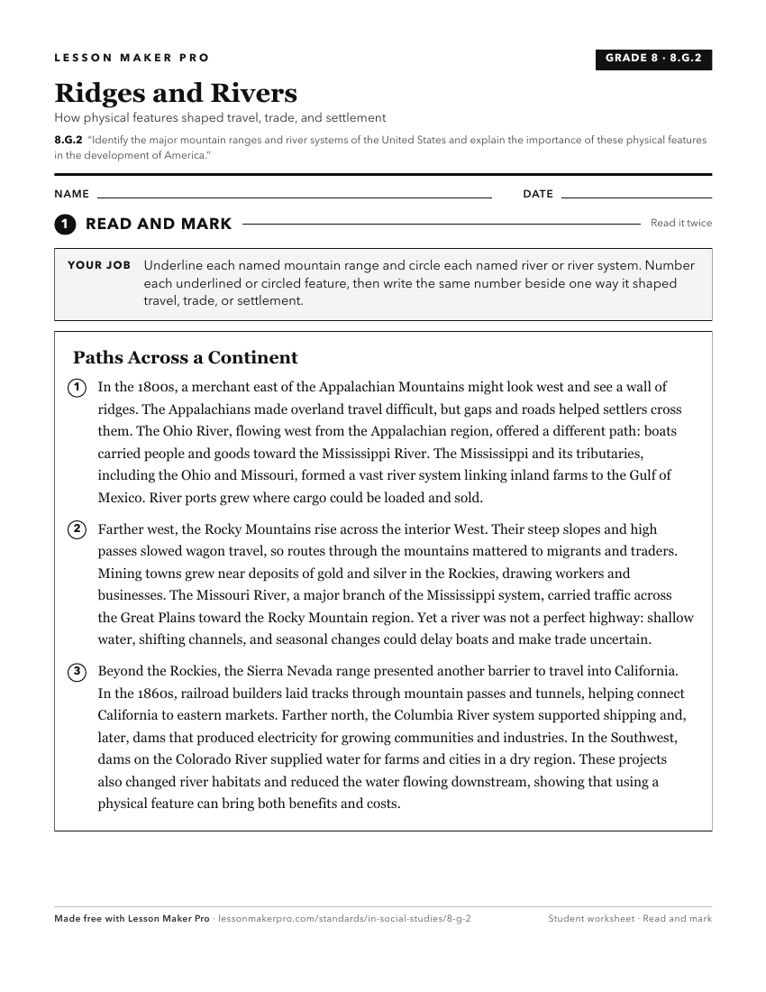
A ready-to-print activity worksheet aligned to 8.G.2, with an answer key for the teacher on its own page. No account needed.
PDF, US Letter, prints cleanly in black and white.
Download the worksheetKeep exploring
Related Standards
- 5.G.2
Use maps and globes to locate states, capitals, major cities, major rivers, the Great Lakes, and mountain ranges in the United States.
- 7.G.4
Identify major physical characteristics of regions of Africa, Asia, and the Southwest Pacific, such as deserts, basins, plains, mountains, and rivers, and descr...
- 5.G.3
Locate the continental divide, the major drainage basins/watersheds, major sources of freshwater in the United States, and identify their impact on local and re...
- 8.G.3
Identify the agricultural regions of the United States. Give explanations for how the land was used and developed during the growth of the United States.
Turn this exact standard into a lesson
Grade, subject, topic, and the complete standard are prefilled. Create one free, no account needed.
Also for this standard:Make a WorksheetMake a QuizMake a Sub Lesson