Indiana Social Studies 8.G.7
The Standard
Identify and interpret maps, graphs, and charts showing the distribution of natural resources such as forests, water sources, and wildlife in the United States at the beginning of the nineteenth century. Give examples of how people exploited these resources as the country became more industrialized and people moved westward.
2026 Indiana Academic Standards: K-12 Social Studies
Teacher's field guide
What This Standard Means
What Students Need to Do
- Students read maps, graphs, and charts to find where forests, rivers, and wildlife were found in the early 1800s. They explain how people used these resources as mills grew and settlers moved west.
What Mastery Looks Like
- A student uses a map key and chart labels to locate a resource. They can explain a specific use, such as cutting timber for lumber, trapping beavers for fur, or using a river to power a mill.
Common Misconceptions
- Students may mistake a forest shown on a map for proof that logging had already happened there. They may treat modern state borders as if they existed in 1800. Some assume every river shown had a mill.
How to Assess It
- Show an early 1800s forest map and a bar chart of forest area by region. Ask: 'Which region had the most forest, and how might people have used its timber? Cite one detail from each source.'
Lesson moves
Ways to Teach It
Give pairs a printed early 1800s forest and river map; have them shade forests and mark a riverbank site for a lumber mill.
Ask, 'Why might a river with nearby forests attract a lumber mill?' Have students write two sentences using map clues.
Play map-match with resource-location cards and logging, fur trade, and mill cards; students pair them and explain each match.
Find the nearest major river on a current map, locate it on an early 1800s map, and suggest one transport or mill use.
Free download
Printable 8.G.7 Worksheet
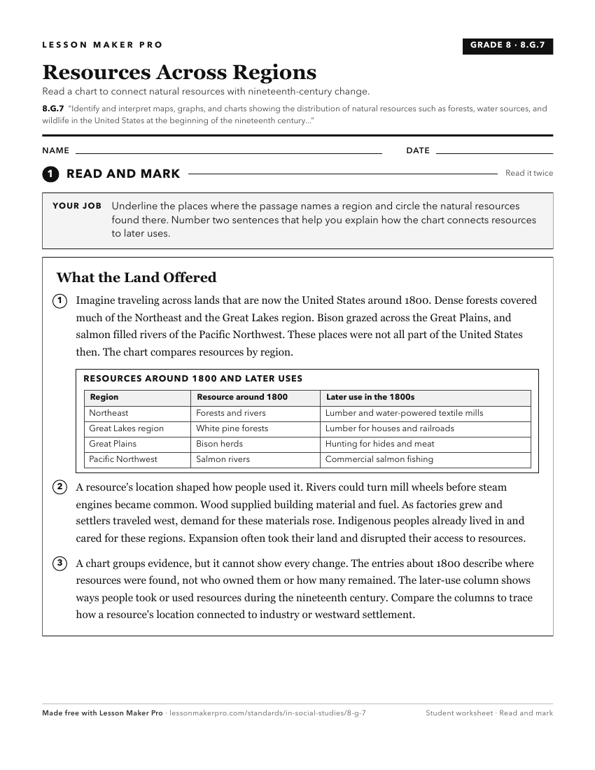
A ready-to-print activity worksheet aligned to 8.G.7, with an answer key for the teacher on its own page. No account needed.
PDF, US Letter, prints cleanly in black and white.
Download the worksheetKeep exploring
Related Standards
- 8.G.4
Using maps, identify changes influenced by growth, economic development, and human migration in the United States.
- GHW.8.1
Use maps to show the location and distribution of Earth’s resources, and analyze how this distribution changes over time and affects trade among countries, regi...
- 8.G.5
Using primary and secondary sources, identify ways people modified the physical environment as the United States developed, and describe the impacts that result...
- 8.G.1
Read and interpret maps that portray the physical growth and development of the United States from colonization through Reconstruction (1877).
Turn this exact standard into a lesson
Grade, subject, topic, and the complete standard are prefilled. Create one free, no account needed.
Also for this standard:Make a WorksheetMake a QuizMake a Sub Lesson