Indiana Social Studies 3.G.4
The Standard
Identify the northern, southern, eastern, and western hemispheres; cardinal and intermediate directions; and determine the direction and distance from one place to another on a variety of maps and globes.
2026 Indiana Academic Standards: K-12 Social Studies
Teacher's field guide
What This Standard Means
What Students Need to Do
- Students use the equator and prime meridian to name a place’s hemispheres. They use map arrows and scales to find the direction and distance between places. They do this on maps and globes.
What Mastery Looks Like
- On a globe, they identify India as being in the Northern and Eastern Hemispheres. On a scaled map, they can say one town is northeast of another and 20 miles away.
Common Misconceptions
- Students may use the equator to split east from west instead of north from south. They may reverse northeast and southwest when they change the starting place. Some read map inches as miles without using the scale.
How to Assess It
- Give students a globe and a map showing Park B 2 inches northeast of School A, with a scale of 1 inch = 5 miles. Ask them to name Australia’s hemispheres, then give Park B’s direction and distance from School A.
Lesson moves
Ways to Teach It
Wrap yarn around a globe to mark the equator and prime meridian, then label India, Australia, and Canada with their hemisphere pairs.
Show School A southwest of Library B on a map and ask, “Which direction is school from the library? How do you know?”
Mark B 2 inches northeast of A on a map labeled “1 inch = 5 miles”; pairs report the direction and distance.
On a scaled town map, have students measure how far and in which direction they would travel from school to the library.
Free download
Printable 3.G.4 Worksheet
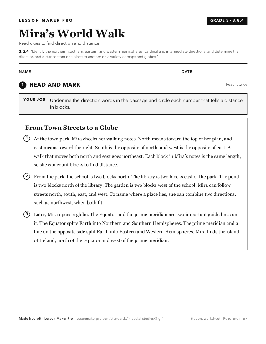
A ready-to-print activity worksheet aligned to 3.G.4, with an answer key for the teacher on its own page. No account needed.
PDF, US Letter, prints cleanly in black and white.
Download the worksheetKeep exploring
Related Standards
- 1.G.1
Identify the cardinal directions (i.e., north, south, east, and west) on maps and globes and at the classroom or school.
- 2.G.2
Locate the equator, the poles, continents, and hemispheres on a world map and on a globe; identify the local community, city, Indiana, the United States, and No...
- 2.G.1
Use a compass to identify cardinal and intermediate directions and locate places on maps and in the classroom, school, and community.
- 1.G.2
Identify and describe continents, hemispheres, oceans, cities, and roads on maps and globes.
Turn this exact standard into a lesson
Grade, subject, topic, and the complete standard are prefilled. Create one free, no account needed.
Also for this standard:Make a WorksheetMake a QuizMake a Sub Lesson