Georgia SS4G2.a
The Standard
- SS4G2
- Describe how physical systems affect human systems.
Explain how each force (American and British) attempted to use the physical geography of each battle site (Lexington and Concord, Saratoga, and Yorktown) to its benefit.
Georgia Standards of Excellence for Social Studies · Describe how physical systems affect human systems.
Teacher's field guide
What This Standard Means
What Students Need to Do
- Students read battle maps and identify roads, rivers, hills, woods, ports, and narrow land areas. They explain how commanders used those features for movement, defense, supply, attack, or escape at all three sites.
What Mastery Looks Like
- Students explain that British troops used the Concord road, while colonial militia used woods, walls, and local routes during the retreat. They connect British movement along the Hudson River and American defenses on Bemis Heights to Saratoga. They explain how Yorktown offered Britain sea access but allowed American and French forces to trap it by land and water.
Common Misconceptions
- Students may name a river or hill without explaining its military advantage. They often mix up the battles, assume both armies used terrain the same way, or treat the British trap at Yorktown as their original plan.
How to Assess It
- Give students a six-cell exit ticket, with American and British columns and rows for Lexington and Concord, Saratoga, and Yorktown. Require one geographic feature and its intended advantage in each cell.
Lesson moves
Ways to Teach It
Build three tabletop battle maps with paper, yarn, blocks, and counters, then move each army to show how terrain shaped its plan.
Ask students to write: Which army used geography most effectively at one battle, and what two map details support your claim?
Sort cards showing roads, rivers, heights, woods, ports, and strategies into the correct battle and army, then check with a partner.
Plan a school event route around gates, slopes, and narrow paths, then compare those choices with one army's battlefield plan.
Free download
Printable SS4G2.a Worksheet
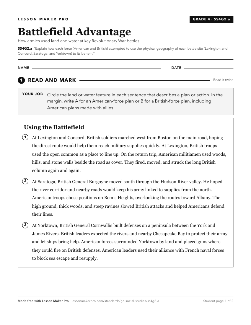
A ready-to-print activity worksheet aligned to SS4G2.a, with an answer key for the teacher on its own page. No account needed.
PDF, US Letter, prints cleanly in black and white.
Download the worksheetKeep exploring
Related Standards
- SS3G3.c
Explain how the physical geography of the New England, Mid-Atlantic, and Southern colonies helped determine economic activities.
- SS4H1.c
Describe the major events of the American Revolution and explain the factors leading to American victory and British defeat; include the Battles of Lexington an...
- SS8H3.c
Analyze the significance of the Loyalists and Patriots as a part of Georgia's role in the Revolutionary War; include the Battle of Kettle Creek and Siege of Sav...
- SS3H3
Explain the factors that shaped British Colonial America.
Turn this exact standard into a lesson
Grade, subject, topic, and the complete standard are prefilled. Create one free, no account needed.
Also for this standard:Make a WorksheetMake a QuizMake a Sub Lesson