Georgia SS3G3.c
The Standard
- SS3G3
- Describe how physical systems affect human systems.
Explain how the physical geography of the New England, Mid-Atlantic, and Southern colonies helped determine economic activities.
Georgia Standards of Excellence for Social Studies · Describe how physical systems affect human systems.
Teacher's field guide
What This Standard Means
What Students Need to Do
- Students connect each colonial region’s climate, land, waterways, soil, and resources to the work people did there. They explain these links using cause-and-effect language.
What Mastery Looks Like
- Students correctly match New England with fishing and shipbuilding, the Mid-Atlantic with grain farming and trade, and the South with cash crops. They support each match with a specific geographic reason.
Common Misconceptions
- Students may think all three regions had the same climate, soil, and farming conditions. They may name an economic activity without explaining how geography supported it. Some confuse the Mid-Atlantic grain economy with Southern plantation crops.
How to Assess It
- Give students one region and ask: Name one economic activity and explain how one physical feature supported it. Require a complete because statement.
Lesson moves
Ways to Teach It
Give groups three region maps, feature cards, and job cards; students sort the cards and connect each feature to an activity with yarn.
Write: Which colonial region best supported grain farming, and what two geographic features made that work possible?
Play a matching game pairing rocky soil, fertile valleys, forests, rivers, and long growing seasons with likely colonial economic activities.
Examine a Georgia crop map and explain how climate, soil, or waterways still shape one local farming or business choice.
Free download
Printable SS3G3.c Worksheet
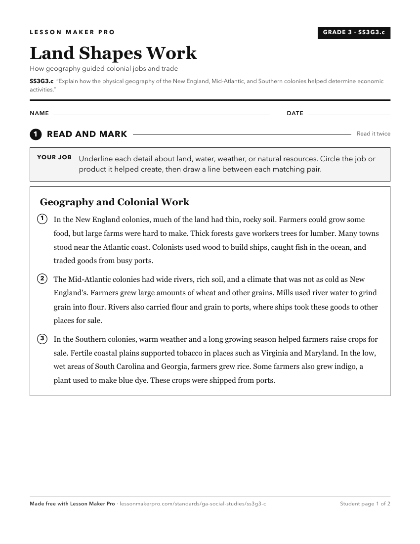
A ready-to-print activity worksheet aligned to SS3G3.c, with an answer key for the teacher on its own page. No account needed.
PDF, US Letter, prints cleanly in black and white.
Download the worksheetKeep exploring
Related Standards
- SS3H3.b
Compare and contrast colonial life in the New England, Mid-Atlantic, and Southern colonies (education, economy, and religion).
- SS3H3.a
Identify key reasons why the New England, Mid-Atlantic, and Southern colonies were founded (religious freedom and profit).
- SS5G2
Explain the reasons for the spatial patterns of economic activities.
- SS3H3
Explain the factors that shaped British Colonial America.
Turn this exact standard into a lesson
Grade, subject, topic, and the complete standard are prefilled. Create one free, no account needed.
Also for this standard:Make a WorksheetMake a QuizMake a Sub Lesson