Florida SS.8.G.2.1
The Standard
- SS.8.G.2
- Understand physical and cultural characteristics of places.
Identify the physical elements and the human elements that define and differentiate regions as relevant to American history.
Florida Next Generation Sunshine State Standards for Social Studies
Teacher's field guide
What This Standard Means
What Students Need to Do
- Students identify landforms, climate, waterways, resources, settlement patterns, economies, cultures, and boundaries that distinguish U.S. regions. They use maps and historical evidence to explain how those features shaped events and regional differences.
What Mastery Looks Like
- Given a map or source, students can name the region, cite physical and human evidence, and distinguish between the two types. They can explain a clear link between a regional feature and a historical development, such as plantation agriculture or western migration.
Common Misconceptions
- Students often treat state borders as the only regional boundaries or assume regions never change. They may label cities, population, and economic activity as physical features, or claim geography alone caused historical events.
How to Assess It
- Exit ticket: Choose one U.S. region, name one physical feature and one human feature, then explain how either feature shaped its history.
Lesson moves
Ways to Teach It
Give pairs a blank U.S. map, landform cards, and settlement cards, then have them build and explain three historical regions.
Ask students to write: How did one physical feature shape work, settlement, or culture in the Northeast, South, or West?
Play Region Riddles: teams identify a region from three clues, then sort each clue as physical or human.
Compare a current Census map with an 1800s population map and explain how transportation, climate, or jobs changed one region.
Free download
Printable SS.8.G.2.1 Worksheet
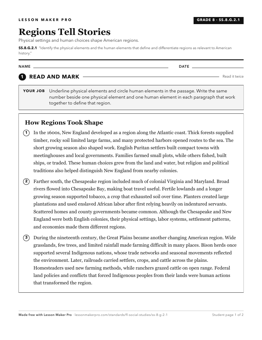
A ready-to-print activity worksheet aligned to SS.8.G.2.1, with an answer key for the teacher on its own page. No account needed.
PDF, US Letter, prints cleanly in black and white.
Download the worksheetKeep exploring
Related Standards
- SS.7.G.2.3
Explain how major physical characteristics, natural resources, climate, and absolute and relative location have influenced settlement, economies, and inter-gove...
- SS.8.G.1.2
Use appropriate geographic tools and terms to identify and describe significant places, and regions in American history.
- SS.8.G.1.1
Use maps to explain physical and cultural attributes of major regions throughout American history.
- SS.8.G.2.3
Use geographic terms and tools to analyze case studies of how selected regions of the United States have changed over time.
Turn this exact standard into a lesson
Grade, subject, topic, and the complete standard are prefilled. Create one free, no account needed.
Also for this standard:Make a WorksheetMake a QuizMake a Sub Lesson