Florida SS.6.W.4.10
The Standard
- SS.6.W.4
- Recognize significant events, figures, and contributions of classical Asian civilizations (i.e., China, India).
Explain the significance of the silk roads and maritime routes across the Indian Ocean to the movement of goods and ideas among Asia, East Africa, and the Mediterranean Basin.
Florida Next Generation Sunshine State Standards for Social Studies
Teacher's field guide
What This Standard Means
What Students Need to Do
- Students locate major overland and sea trade networks on a map. They track how products, beliefs, knowledge, and technology passed among China, India, African ports, and Mediterranean societies. They explain how those exchanges changed economies and cultures.
What Mastery Looks Like
- A student can distinguish an overland route from an Indian Ocean route and label likely goods moving on each. The student uses a specific example, such as silk or Buddhism, to explain an economic or cultural effect.
Common Misconceptions
- Students may picture the Silk Roads as one road used by a single merchant from start to finish. They may think trade moved in one direction, ignore monsoon winds, or assume only goods traveled. Some also place East African ports on Mediterranean land routes.
How to Assess It
- Give students a blank Afro-Eurasia map. Ask them to draw one land route and one sea route, label two goods and one idea, then explain one effect in two sentences.
Lesson moves
Ways to Teach It
Give groups a map, yarn, and cards naming silk, spices, ivory, Buddhism, and ship technology, then have them build and explain exchange paths.
Ask, “Which route changed societies more, land or sea?” Students write a claim and support it with two mapped examples.
Run a trade route relay where teams move goods and idea cards through linked city and port stations, then score accurate destinations.
Use a modern shipping map to compare a container route from China to the Mediterranean with historical sea routes, noting two shared stops or barriers.
Free download
Printable SS.6.W.4.10 Worksheet
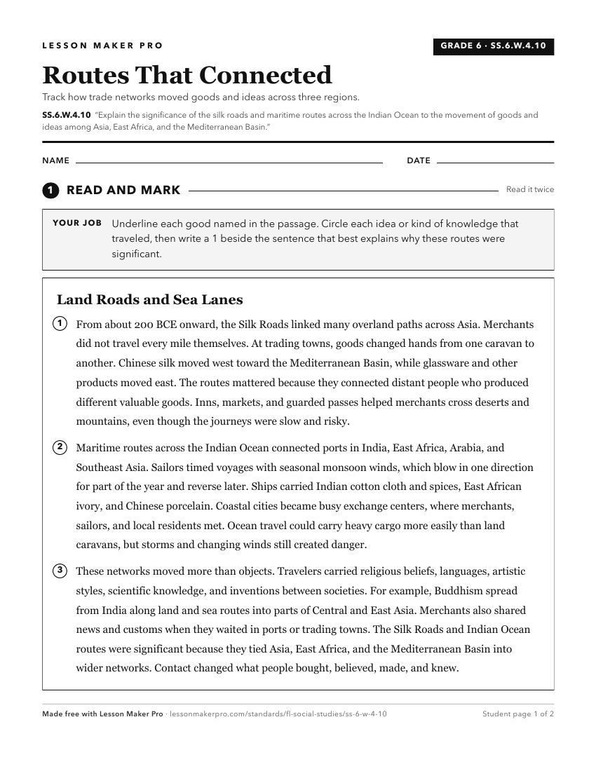
A ready-to-print activity worksheet aligned to SS.6.W.4.10, with an answer key for the teacher on its own page. No account needed.
PDF, US Letter, prints cleanly in black and white.
Download the worksheetKeep exploring
Related Standards
- SS.68.AA.1.1
Identify Afro-Eurasian trade routes and methods prior to the development of the Atlantic slave trade.
- SS.5.A.4.5
Explain the importance of Triangular Trade linking Africa, the West Indies, the British Colonies, and Europe.
- SS.6.E.3.2
Categorize products that were traded among civilizations, and give examples of barriers to trade of those products.
- SS.6.G.5.2
Use geographic terms and tools to explain why ancient civilizations developed networks of highways, waterways, and other transportation linkages.
Turn this exact standard into a lesson
Grade, subject, topic, and the complete standard are prefilled. Create one free, no account needed.
Also for this standard:Make a WorksheetMake a QuizMake a Sub Lesson