Florida SS.6.G.2.4
The Standard
- SS.6.G.2
- Understand physical and cultural characteristics of places.
Explain how the geographical location of ancient civilizations contributed to the culture and politics of those societies.
Florida Next Generation Sunshine State Standards for Social Studies
Teacher's field guide
What This Standard Means
What Students Need to Do
- Students connect rivers, seas, mountains, deserts, and trade routes to how ancient societies lived and governed. They explain these links using map evidence and clear cause-and-effect statements.
What Mastery Looks Like
- Given a map, students can identify a geographic feature and explain one cultural effect and one political effect. They use specific examples such as farming, trade, defense, borders, or centralized government.
Common Misconceptions
- Students may name a river or mountain without explaining how it affected society. They may confuse culture with government, or claim geography completely determined what happened.
How to Assess It
- Display a map of ancient Egypt. Ask: How did the Nile and surrounding deserts contribute to one cultural practice and one political feature? Use two map details.
Lesson moves
Ways to Teach It
Give pairs clay, blue yarn, and index cards to model Egypt's rivers, deserts, trade routes, farms, and government center.
Ask students to write: Which shaped ancient Greece more, mountains or seas, and what cultural and political evidence supports your claim?
Play a card match where teams pair a civilization, geographic feature, cultural effect, and political effect, then defend each set.
Compare a local city map with an ancient settlement map, noting how water, routes, and barriers still influence community decisions.
Free download
Printable SS.6.G.2.4 Worksheet
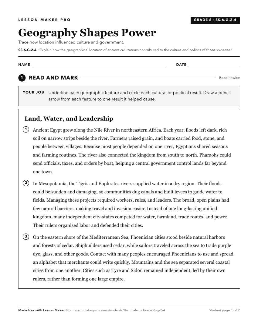
A ready-to-print activity worksheet aligned to SS.6.G.2.4, with an answer key for the teacher on its own page. No account needed.
PDF, US Letter, prints cleanly in black and white.
Download the worksheetKeep exploring
Related Standards
- SS.6.G.4.1
Explain how family and ethnic relationships influenced ancient cultures.
- SS.6.G.1.7
Use maps to identify characteristics and boundaries of ancient civilizations that have shaped the world today.
- SS.6.G.2.1
Explain how major physical characteristics, natural resources, climate, and absolute and relative locations have influenced settlement, interactions, and the ec...
- SS.6.G.2.3
Analyze the relationship of physical geography to the development of ancient river valley civilizations.
Turn this exact standard into a lesson
Grade, subject, topic, and the complete standard are prefilled. Create one free, no account needed.
Also for this standard:Make a WorksheetMake a QuizMake a Sub Lesson