Florida SS.5.G.1.5
The Standard
- SS.5.G.1
- The World in Spatial Terms
Identify and locate the original thirteen colonies on a map of North America.
Florida Next Generation Sunshine State Standards for Social Studies
Teacher's field guide
What This Standard Means
What Students Need to Do
- Students name all thirteen colonies and place each one in the correct location on a map of eastern North America. They use coastlines and neighboring colonies as location clues.
What Mastery Looks Like
- Students correctly label all thirteen colonies on an unlabeled map. They can also point to a named colony and describe its location using nearby colonies or landmarks.
Common Misconceptions
- Students often include Florida, Vermont, or Maine as separate colonies. They may also confuse New York with New Jersey or mix up the small New England colonies.
How to Assess It
- Give students a blank colonial map and a word bank. Ask them to label all thirteen colonies without using notes.
Lesson moves
Ways to Teach It
Give pairs a blank map and colony name cards to place, check with an atlas, and glue in position.
Ask students to write which three colonies are hardest to locate and explain one map clue for each.
Play a map relay where teams draw colony cards and point to each location on a projected blank map.
Compare a colonial map with a current United States map, noting which colony names became state names and where boundaries changed.
Free download
Printable SS.5.G.1.5 Worksheet
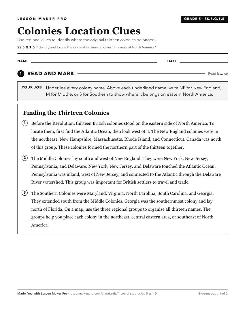
A ready-to-print activity worksheet aligned to SS.5.G.1.5, with an answer key for the teacher on its own page. No account needed.
PDF, US Letter, prints cleanly in black and white.
Download the worksheetKeep exploring
Related Standards
- SS.5.A.4.3
Identify significant individuals responsible for the development of the New England, Middle, and Southern colonies.
- SS.2.G.1.4
Use a map to locate the countries in North America (Canada, United States, Mexico, and the Caribbean Islands).
- SS.5.G.1.3
Identify major United States physical features on a map of North America.
- SS.5.G.1.6
Locate and identify states, capitals, and United States Territories on a map.
Turn this exact standard into a lesson
Grade, subject, topic, and the complete standard are prefilled. Create one free, no account needed.
Also for this standard:Make a WorksheetMake a QuizMake a Sub Lesson