Florida SS.3.G.1.4
The Standard
- SS.3.G.1
- The World in Spatial Terms
Name and identify the purpose of maps (physical, political, elevation, population).
Florida Next Generation Sunshine State Standards for Social Studies
Teacher's field guide
What This Standard Means
What Students Need to Do
- Students identify physical, political, elevation, and population maps. They explain what information each map shows and when someone would use it.
What Mastery Looks Like
- Given an unfamiliar map, students name its type using clues such as boundaries, landforms, elevation colors, or population shading. They choose the best map for a specific question.
Common Misconceptions
- Students may confuse physical maps with elevation maps because both show land features. They may think political maps show elections or that population maps show exact locations of people.
How to Assess It
- Show four small maps and ask: “Name each map type, then write one question each map could help answer.”
Lesson moves
Ways to Teach It
Give groups printed maps to sort into four types, then have them circle the clues that guided each choice.
Ask students to write which map they would use to plan a mountain hike, compare state borders, or find crowded areas.
Play Map Match by having students pair map cards with question cards, such as “Where are the highest areas?”
Have students select the best map for a new store, road trip, state report, or hiking trail and explain why.
Free download
Printable SS.3.G.1.4 Worksheet
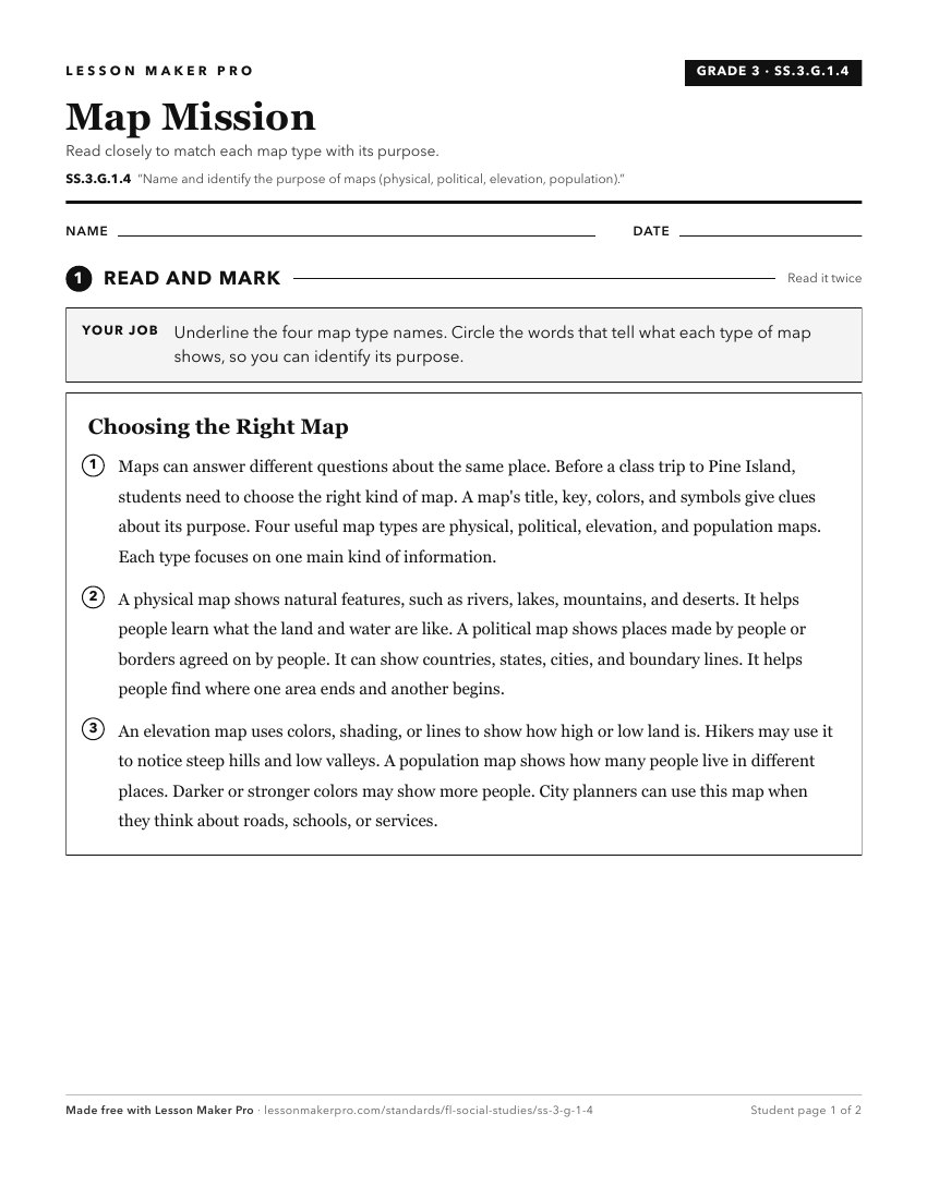
A ready-to-print activity worksheet aligned to SS.3.G.1.4, with an answer key for the teacher on its own page. No account needed.
PDF, US Letter, prints cleanly in black and white.
Download the worksheetKeep exploring
Related Standards
- SS.1.G.1.4
Identify a variety of physical features using a map and globe.
- SS.4.G.1.4
Interpret political and physical maps using map elements (title, compass rose, cardinal directions, intermediate directions, symbols, legend, scale, longitude, ...
- SS.6.G.1.2
Analyze the purposes of map projections (e.g., political, physical, special purpose) and explain the applications of various types of maps.
- SS.2.G.1.1
Use different types of maps (political, physical, and thematic) to identify map elements.
Turn this exact standard into a lesson
Grade, subject, topic, and the complete standard are prefilled. Create one free, no account needed.
Also for this standard:Make a WorksheetMake a QuizMake a Sub Lesson