Alabama Social Studies SS24.7.1d
The Standard
- SS24.7.1
- Describe the world in spatial terms, using maps and other geographic representations, tools, and geospatial technologies.
Describe how geographic features and political entities are organized and labeled, including continents, countries, and oceans.
2024 Alabama Course of Study: Social Studies
Teacher's field guide
What This Standard Means
What Students Need to Do
- Students locate and label continents, countries, and oceans on a map. They use coastlines and country borders to place each name.
What Mastery Looks Like
- On a map of Africa, students label Africa, Egypt, and the Atlantic Ocean in the right places. They explain that Egypt is a country within Africa and the Atlantic Ocean lies west of it.
Common Misconceptions
- Students may call Africa a country or Egypt a continent. They may put ocean names on land or mistake country borders for coastlines.
How to Assess It
- Give students a blank map of Africa with country borders and surrounding water. Ask them to label Africa, Egypt, and the Atlantic Ocean, then identify which label names a country.
Lesson moves
Ways to Teach It
Give pairs a blank world map and an atlas; have them color continents, label oceans, and mark Egypt, Brazil, and Japan.
Show a map of Africa and ask students to explain why Egypt is a country but Africa is a continent.
Play map bingo with cards naming places; call clues such as 'country in northeast Africa' and 'ocean west of Africa.'
On a printed shipping route map, trace Morocco to Brazil and label both countries, their continents, and the Atlantic Ocean.
Free download
Printable SS24.7.1d Worksheet
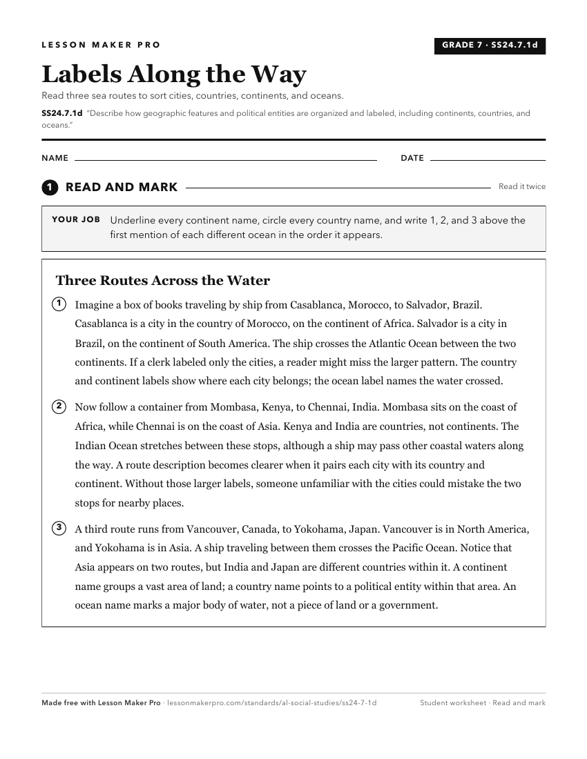
A ready-to-print activity worksheet aligned to SS24.7.1d, with an answer key for the teacher on its own page. No account needed.
PDF, US Letter, prints cleanly in black and white.
Download the worksheetKeep exploring
Related Standards
- SS24.2.7
Identify the seven continents, the five oceans, and the Equator shown on maps, globes, and satellite and digital images.
- SS24.1.9
Differentiate among landforms, bodies of water, and other physical features on maps, globes, and satellite and digital images.
- SS24.1.8
Describe the features of political and physical maps.
- SS24.3.1
Locate map features, using geographic terminology to describe them.
Turn this exact standard into a lesson
Grade, subject, topic, and the complete standard are prefilled. Create one free, no account needed.
Also for this standard:Make a WorksheetMake a QuizMake a Sub Lesson