Virginia SOL 6.6.e
The Standard
- 6.6
- The student will investigate and understand that water has unique physical properties and has a role in the natural and human-made environment. Key ideas include
large bodies of water moderate climate
Virginia Standards of Learning for Science
Teacher's field guide
What This Standard Means
What Students Need to Do
- Students compare temperatures in coastal and inland places. They explain how water warms and cools more slowly than land, reducing nearby temperature swings.
What Mastery Looks Like
- Students can read climate data and identify the location most influenced by nearby water. They use seasonal temperature ranges and distance from water to support their choice.
Common Misconceptions
- Students may think water always makes nearby places colder or that climate and daily weather are the same. They may also assume latitude is the only factor affecting temperature.
How to Assess It
- Give students climate graphs for two cities at the same latitude, one coastal and one inland. Ask which city is coastal and require one data-based reason.
Lesson moves
Ways to Teach It
Place equal amounts of sand and water under a lamp, record temperatures every two minutes, then compare cooling rates after turning it off.
Ask students to explain why a beach town and an inland town at the same latitude can have different seasonal temperature ranges.
Give pairs city climate cards and maps, then have them match each graph to a coastal or inland location and defend each match.
Compare monthly temperatures for San Francisco and Sacramento, then write a short forecast explaining how the Pacific Ocean affects each city's climate.
Free download
Printable 6.6.e Worksheet
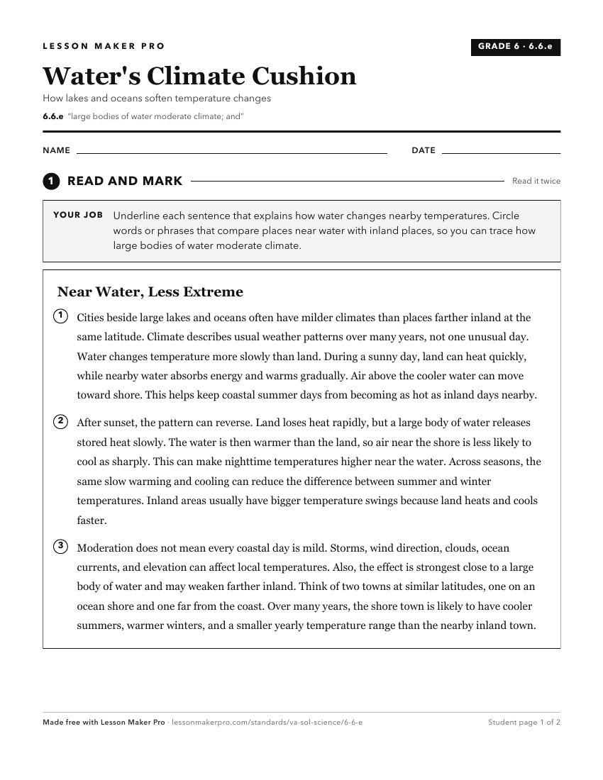
A ready-to-print activity worksheet aligned to 6.6.e, with an answer key for the teacher on its own page. No account needed.
PDF, US Letter, prints cleanly in black and white.
Download the worksheetKeep exploring
Related Standards
Turn this exact standard into a lesson
Grade, subject, topic, and the complete standard are prefilled. Create one free, no account needed.
Also for this standard:Make a WorksheetMake a QuizMake a Sub Lesson