Virginia SOL WG.8.a
The Standard
- WG.8
- The student will analyze the characteristics of the regions of North Africa and Southwest Asia by
identifying and analyzing the location of major geographic regions and major cities on maps and globes
Virginia Standards of Learning for History and Social Science · The student will analyze the characteristics of the regions of North Africa and Southwest Asia regions by
Teacher's field guide
What This Standard Means
What Students Need to Do
- Students locate North Africa and Southwest Asia on maps and globes. They identify major regions and cities, then explain locations using nearby landforms, bodies of water, countries, and relative direction.
What Mastery Looks Like
- Students accurately label regions such as the Maghreb, Nile Valley, Levant, Mesopotamia, and Arabian Peninsula. They locate cities such as Cairo, Istanbul, Jerusalem, Baghdad, Tehran, and Mecca and describe spatial patterns.
Common Misconceptions
- Students often treat North Africa and Southwest Asia as one continent or place every city in the Arabian Peninsula. They may confuse countries with cities or misread relative locations around the Mediterranean Sea, Red Sea, and Persian Gulf.
How to Assess It
- Give students a blank regional map and ask them to label three regions and four cities. Have them write one sentence describing each city's relative location.
Lesson moves
Ways to Teach It
Give pairs a blank map, city cards, region labels, and yarn to connect each city to nearby seas, rivers, or landforms.
Ask students to explain why Cairo, Istanbul, and Baghdad developed where they did, using water, trade routes, and surrounding landforms.
Play map relay with teams placing labeled city and region cards on a large projected or floor map.
Use airline route maps to plan a trip through four major cities and describe the direction traveled between each stop.
Free download
Printable WG.8.a Worksheet
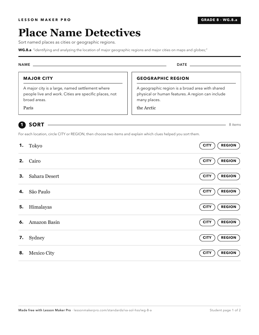
A ready-to-print activity worksheet aligned to WG.8.a, with an answer key for the teacher on its own page. No account needed.
PDF, US Letter, prints cleanly in black and white.
Download the worksheetKeep exploring
Related Standards
Turn this exact standard into a lesson
Grade, subject, topic, and the complete standard are prefilled. Create one free, no account needed.
Also for this standard:Make a WorksheetMake a QuizMake a Sub Lesson