Virginia SOL WG.11.a
The Standard
- WG.11
- The student will analyze the characteristics of the Australian and Pacific Islands regions by
identifying and analyzing the location of major geographic regions and major cities on maps and globes
Virginia Standards of Learning for History and Social Science · The student will analyze the characteristics of the Australian and Pacific Islands regions by
Teacher's field guide
What This Standard Means
What Students Need to Do
- Students locate Australia, New Zealand, Melanesia, Micronesia, and Polynesia on maps and globes. They identify major cities and explain location patterns using direction, distance, coastlines, and nearby land or water.
What Mastery Looks Like
- Students accurately label major regions and cities such as Sydney, Melbourne, Canberra, Auckland, and Wellington. They describe each location using clear geographic references and compare regional settlement patterns.
Common Misconceptions
- Students often treat the Pacific Islands as one region or confuse Melanesia, Micronesia, and Polynesia. They may mistake Sydney for Australia’s capital or place New Zealand northwest of Australia.
How to Assess It
- Give students a blank regional map and ask them to label three regions and four cities. Then ask, “What location pattern do these cities share?”
Lesson moves
Ways to Teach It
Place region and city cards on a large floor map, then have students justify each placement using nearby oceans, islands, and coastlines.
Write a response to this prompt: Why are many major cities in Australia and New Zealand located near the coast?
Run a map relay where teams locate named regions and cities, then earn a bonus point for stating a correct relative location.
Plan a flight from Sydney to Auckland, marking both cities and describing the direction, ocean crossed, and approximate distance using map scale.
Free download
Printable WG.11.a Worksheet
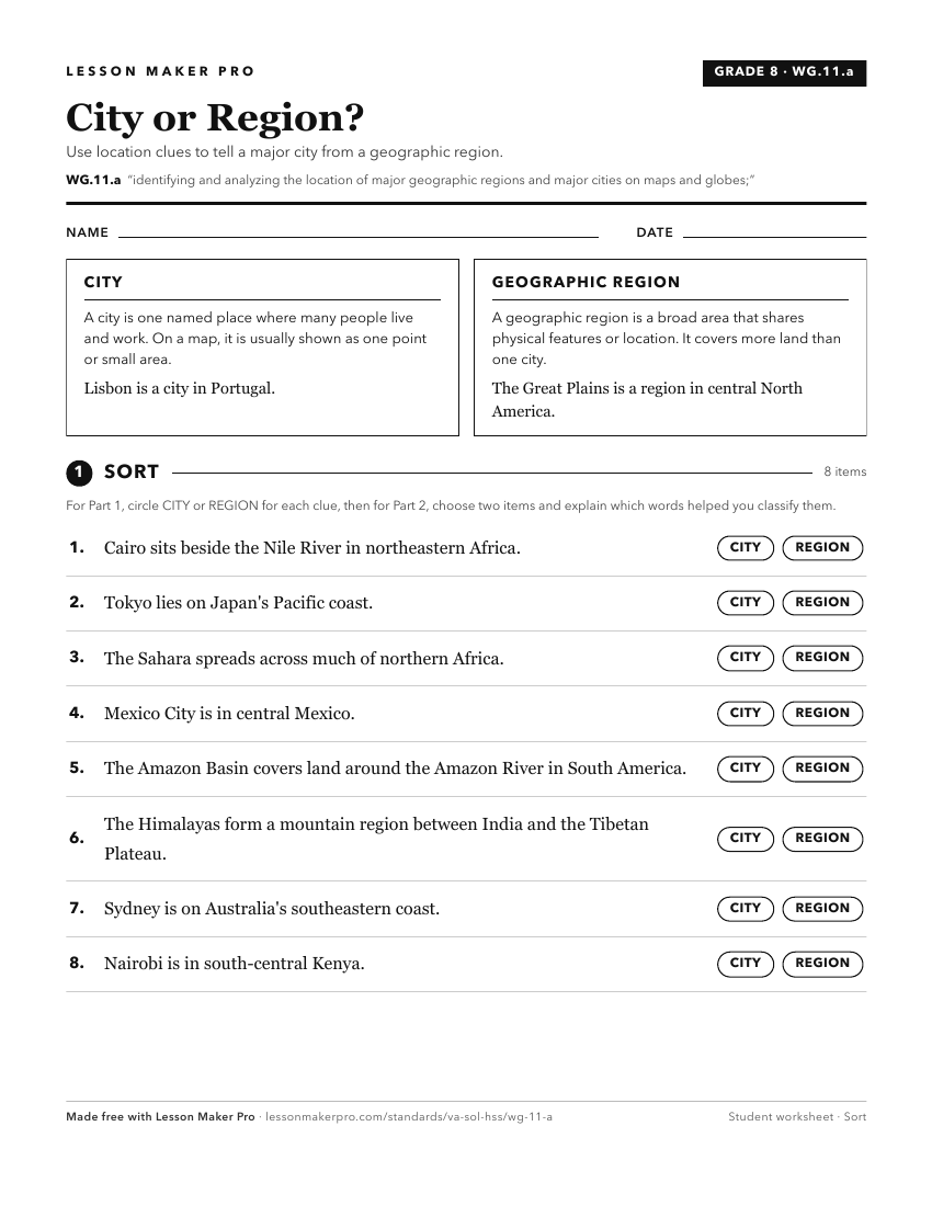
A ready-to-print activity worksheet aligned to WG.11.a, with an answer key for the teacher on its own page. No account needed.
PDF, US Letter, prints cleanly in black and white.
Download the worksheetKeep exploring
Related Standards
Turn this exact standard into a lesson
Grade, subject, topic, and the complete standard are prefilled. Create one free, no account needed.
Also for this standard:Make a WorksheetMake a QuizMake a Sub Lesson