Virginia SOL WG.15.a
The Standard
- WG.15
- The student will apply history and social science skills to analyze the patterns of rural and urban migration and development by
applying the concepts of site and situation to major cities in each region
Virginia Standards of Learning for History and Social Science
Teacher's field guide
What This Standard Means
What Students Need to Do
- Students identify the physical features that shaped where a major city developed. They explain how nearby waterways, resources, transportation routes, and other places support its growth.
What Mastery Looks Like
- Given a map, students can describe a city’s site and situation with accurate evidence. They can explain how location affects trade, transportation, settlement, or influence.
Common Misconceptions
- Students often confuse site with situation, or give coordinates instead of explaining location advantages. They may name a river, port, or route without connecting it to city growth.
How to Assess It
- Exit ticket: Using a map of Cairo, write one site statement, one situation statement, and one sentence explaining how either affected city growth.
Lesson moves
Ways to Teach It
Use clay, string, and map tiles to build a city beside physical features and routes, then label its site and situation.
Write a claim explaining whether Singapore’s site or situation better explains its growth, using two details from maps.
Play a city clue sort: teams place cards under site or situation, then match them to Tokyo, Cairo, or São Paulo.
Study your nearest city on physical and transportation maps, then explain how one location feature affects jobs, trade, or travel.
Free download
Printable WG.15.a Worksheet
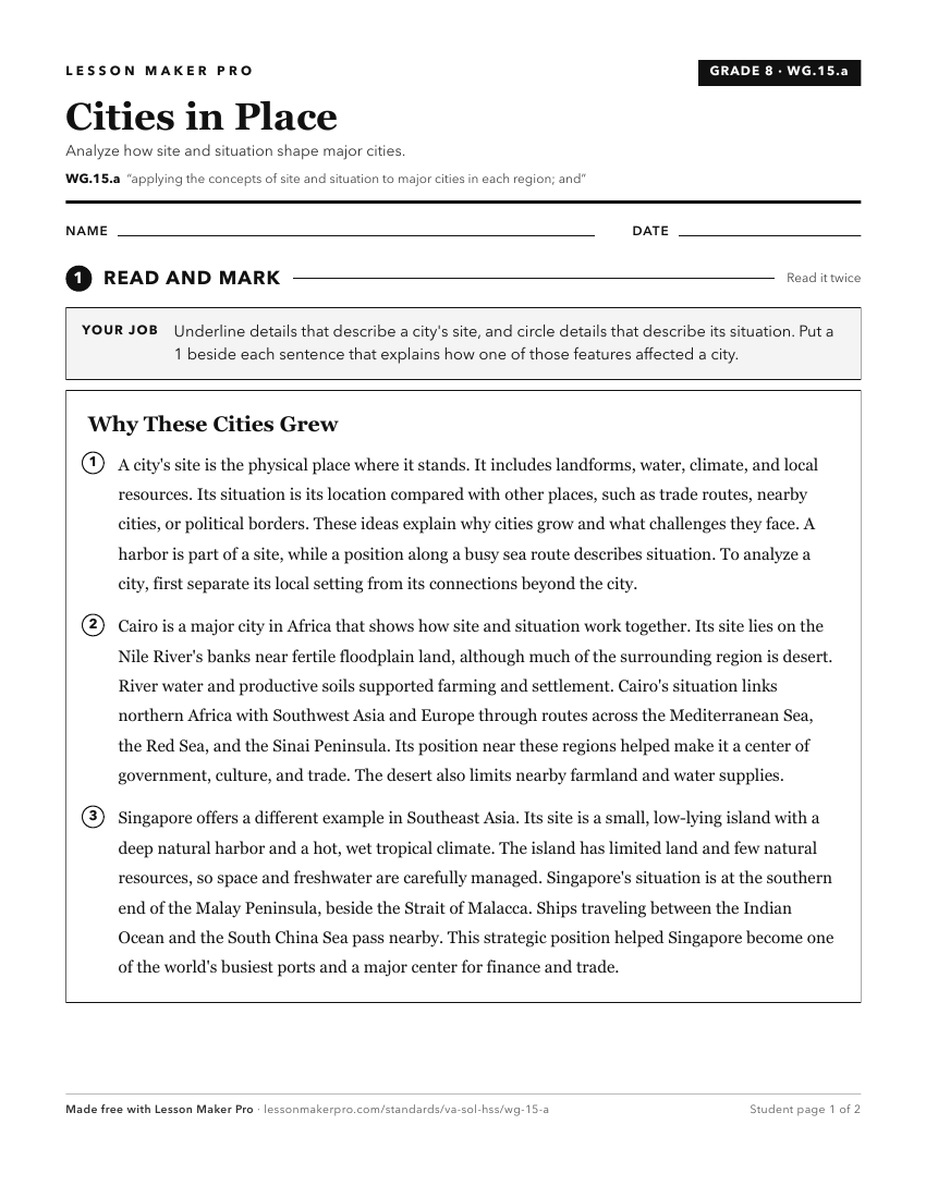
A ready-to-print activity worksheet aligned to WG.15.a, with an answer key for the teacher on its own page. No account needed.
PDF, US Letter, prints cleanly in black and white.
Download the worksheetKeep exploring
Related Standards
- WG.10.a
identifying and analyzing the location of major geographic regions and major cities on maps and globes
- USI.5.d
explaining the specialization and interdependence of the regions
- WG.11.a
identifying and analyzing the location of major geographic regions and major cities on maps and globes
- WG.3.a
identifying and analyzing the location of major geographic regions and major cities on maps and globes
Turn this exact standard into a lesson
Grade, subject, topic, and the complete standard are prefilled. Create one free, no account needed.
Also for this standard:Make a WorksheetMake a QuizMake a Sub Lesson