Virginia SOL WG.1.d
The Standard
- WG.1
- The student will apply history and social science skills to explain how geographic information and geospatial tools are used to make decisions by
explaining how cartography is used to reflect regional perspectives, points of view, and perceptions of an area and the creation of mental maps.
Virginia Standards of Learning for History and Social Science · The student will apply history and social science skills to explain how geographic information and geospatial tools are used to make decisions by
Teacher's field guide
What This Standard Means
What Students Need to Do
- Students examine how projection, scale, symbols, labels, boundaries, and orientation shape what viewers notice on a map. They compare mapped views with mental maps and explain how experience and viewpoint affect each representation.
What Mastery Looks Like
- Given two maps of the same place, students identify specific design choices and explain the viewpoint each map presents. They can draw a mental map and explain why certain places, routes, or landmarks stand out.
Common Misconceptions
- Students may assume all maps are objective, north must be at the top, or larger areas are always more important. They may also treat mental maps as incorrect maps rather than personal representations shaped by experience.
How to Assess It
- Show a Mercator map and an equal-area world map. Ask students to name two differences and explain how each could shape a viewer’s perception of regions.
Lesson moves
Ways to Teach It
Have students draw the route from school to a familiar place from memory, then compare it with a digital map and mark differences.
Compare a tourist map and transit map of one city, then write which audience each serves and cite three design choices.
Play Map Detective by showing unlabeled maps and having teams infer the intended audience from symbols, scale, labels, and orientation.
Give students a neighborhood evacuation scenario and have them design a map with selected landmarks, routes, symbols, and a written reason for each choice.
Free download
Printable WG.1.d Worksheet
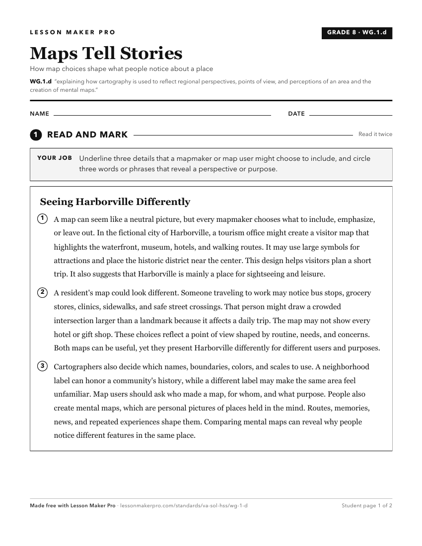
A ready-to-print activity worksheet aligned to WG.1.d, with an answer key for the teacher on its own page. No account needed.
PDF, US Letter, prints cleanly in black and white.
Download the worksheetKeep exploring
Related Standards
- WG.4.a
identifying and analyzing the location of major geographic regions and major cities on maps and globes
- WG.10.a
identifying and analyzing the location of major geographic regions and major cities on maps and globes
- WG.11.a
identifying and analyzing the location of major geographic regions and major cities on maps and globes
- WG.3.a
identifying and analyzing the location of major geographic regions and major cities on maps and globes
Turn this exact standard into a lesson
Grade, subject, topic, and the complete standard are prefilled. Create one free, no account needed.
Also for this standard:Make a WorksheetMake a QuizMake a Sub Lesson