Oklahoma Social Studies WG.P.2.3.C
The Standard
- WG.P.2
- Use interdisciplinary tools to acquire, apply, and evaluate content understanding of the four strands of social studies.
- WG.P.2.3
- Demonstrate a mastery of geographic concepts and the use of geographic tools to understand the impact of geography on the past and present.
Evaluate the extent to which political and economic decisions have had significant impact on human and physical environments of various places and regions.
Oklahoma Academic Standards for Social Studies (2026) · WG.P.2.3
Teacher's field guide
What This Standard Means
What Students Need to Do
- Compare how government and business choices change land, water, and communities in different regions. Use maps and short sources to judge whether a choice was a main cause or one factor among several.
What Mastery Looks Like
- Students can link river diversion to the Aral Sea's shrinkage and lost fishing jobs. They can link Amazon road building to forest clearing and new settlements, then use evidence to weigh other causes.
Common Misconceptions
- Students may call a shrinking lake a human change and lost fishing jobs a physical change. They may blame all forest loss on one road without considering ranching and logging.
How to Assess It
- Exit ticket: River diversions cut most inflow to the Aral Sea for decades. A two-year drought reduced it further, and fishing ports closed. Which cause best explains the sea's shrinkage, and how did the change affect nearby communities?
Lesson moves
Ways to Teach It
Layer tracing paper over before and after maps of the Aral Sea and an Amazon road corridor; circle changes to water, forest, and settlements.
Ask: Did road building or cattle demand do more to change an Amazon forest region? Support your answer with two details from case cards.
Sort printed Aral Sea and Amazon cards into decisions, physical changes, and human changes; connect each decision to two effects.
Place a proposed warehouse on a local map and predict how paved ground and truck traffic could affect runoff and nearby residents.
Free download
Printable WG.P.2.3.C Worksheet
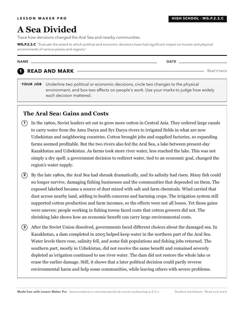
A ready-to-print activity worksheet aligned to WG.P.2.3.C, with an answer key for the teacher on its own page. No account needed.
PDF, US Letter, prints cleanly in black and white.
Download the worksheetKeep exploring
Related Standards
- USH.P.2.3.C
Evaluate the extent to which political and economic decisions have had significant impact on human and physical environments of various places and regions.
- AWH.P.2.3.C
Evaluate the extent to which political and economic decisions have had significant impact on human and physical environments of various places and regions.
- MWH.P.2.3.C
Evaluate the extent to which political and economic decisions have had significant impact on human and physical environments of various places and regions.
- OKH.P.2.3.C
Evaluate the extent to which political and economic decisions have had significant impact on human and physical environments of various places and regions.
Turn this exact standard into a lesson
Grade, subject, topic, and the complete standard are prefilled. Create one free, no account needed.
Also for this standard:Make a WorksheetMake a QuizMake a Sub Lesson