Oklahoma Social Studies TOT.P.2.3.B
The Standard
- TOT.P.2.3
- Demonstrate a mastery of geographic concepts and the use of geographic tools to understand the impact of geography on the past and present.
Compare and analyze complex maps and mapping technologies to analyze spatial patterns of human and physical environments, explaining relationships between the environment and events, past and present.
Oklahoma Academic Standards for Social Studies (2026) · TOT.P.2.3
Teacher's field guide
What This Standard Means
What Students Need to Do
- Students read legends, scales, and dates on past flood maps, current flood risk maps, and digital elevation maps. They compare where people live with low land and flood areas. They explain how terrain and human changes shaped past events and present risks.
What Mastery Looks Like
- A student can point to specific places on two maps to support a claim about flooding. They distinguish an area that flooded in 2005 from an area marked at risk today, and explain how elevation and levees affect both.
Common Misconceptions
- Students may treat a current risk zone as a record of where water reached in 2005. They may blame flooding on elevation alone and miss the role of levees and canals. Some overlook map dates or assume the same color means the same thing on both maps.
How to Assess It
- Show a 2005 Katrina flood extent map and a current FEMA flood risk map of New Orleans. Ask students to name one area shown on both, explain what each map says about it, and cite one clue from each legend.
Lesson moves
Ways to Teach It
Print matching-scale Katrina flood extent and current FEMA flood maps; have pairs use tracing paper to mark two areas shown differently.
Ask: Which mattered more in Katrina flooding, low elevation or levee failure? Require evidence from two labeled maps.
Give teams flood extent, flood risk, elevation, and street map cards; have them match claims to the map and legend that support each.
Open a New Orleans street map beside FEMA's flood map; choose a site for a new clinic and defend its access and flood risk.
Free download
Printable TOT.P.2.3.B Worksheet
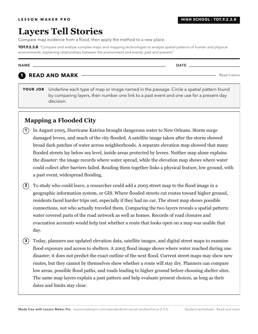
A ready-to-print activity worksheet aligned to TOT.P.2.3.B, with an answer key for the teacher on its own page. No account needed.
PDF, US Letter, prints cleanly in black and white.
Download the worksheetKeep exploring
Related Standards
- OKH.P.2.3.B
Compare and analyze complex maps and mapping technologies to analyze spatial patterns of human and physical environments, explaining relationships between the e...
- AWH.P.2.3.B
Compare and analyze complex maps and mapping technologies to analyze spatial patterns of human and physical environments, explaining relationships between the e...
- E.P.2.3.B
Compare and analyze complex maps and mapping technologies to analyze spatial patterns of human and physical environments, explaining relationships between the e...
- USH.P.2.3.B
Compare and analyze complex maps and mapping technologies to analyze spatial patterns of human and physical environments, explaining relationships between the e...
Turn this exact standard into a lesson
Grade, subject, topic, and the complete standard are prefilled. Create one free, no account needed.
Also for this standard:Make a WorksheetMake a QuizMake a Sub Lesson