Oklahoma Social Studies 8.P.2.3
Standard Cluster
- 8.P.2
- Use interdisciplinary tools to acquire, apply, and evaluate content understanding of the four strands of social studies.
Demonstrate a mastery of geographic concepts and the use of geographic tools to understand the impact of geography on the past and present. Answer geographic questions and conduct investigations by acquiring, organizing, and interpreting information about the modern world and historical events. Use multiple mapping techniques, data visuals, satellite images, and geographic technology to analyze spatial patterns of physical and human characteristics, making connections between regions. Explain how the environment affects cultural patterns and historical events, providing opportunities and challenges for human development.
Oklahoma Academic Standards for Social Studies (2026) · 8.P.2
Cluster contents
Standards in This Cluster
8.P.2.3 is a cluster heading. These are the individual standards under it.
- 8.P.2.3.A
Answer geographic questions and conduct investigations by acquiring, organizing, and interpreting information about the modern world and historical events.
- 8.P.2.3.B
Use multiple mapping techniques, data visuals, satellite images, and geographic technology to analyze spatial patterns of physical and human characteristics, ma...
- 8.P.2.3.C
Explain how the environment affects cultural patterns and historical events, providing opportunities and challenges for human development.
Teacher's field guide
What This Cluster Means
What Students Need to Do
- Students use maps, satellite images, and data charts to find patterns in where people live. They compare regions and time periods, then explain how land and water bring both benefits and problems.
What Mastery Looks Like
- A student uses maps to show that settlements cluster along the Nile and Mississippi rivers. They explain how river water supported farming in the past and still affects where people live. They cite evidence for a risk, such as water shortages or floods.
Common Misconceptions
- Students may think green land on a satellite image always means heavy rainfall, even where irrigation supplies the water. They may assume rivers only help settlements and overlook floods or water shortages.
How to Assess It
- Give students an ancient Egypt settlement map, a current Nile satellite image, and a population map. Ask: “Where do people settle near the Nile in both time periods? Cite two details and name one benefit and one problem of living there.”
Lesson moves
Ways to Teach It
Lay a clear sheet over a printed Nile satellite image; students trace the river and mark ancient settlements using a second map.
Show maps of the Nile and Mississippi floodplains; ask students to write why people settled near both rivers despite the risks.
Give pairs four cards showing rainfall, population, ancient settlements, and satellite views; have them match each card to a claim about the Nile.
Open Google Earth near Cairo; students locate where fields meet desert and predict a water problem for nearby farmers.
Free download
Printable 8.P.2.3 Worksheet
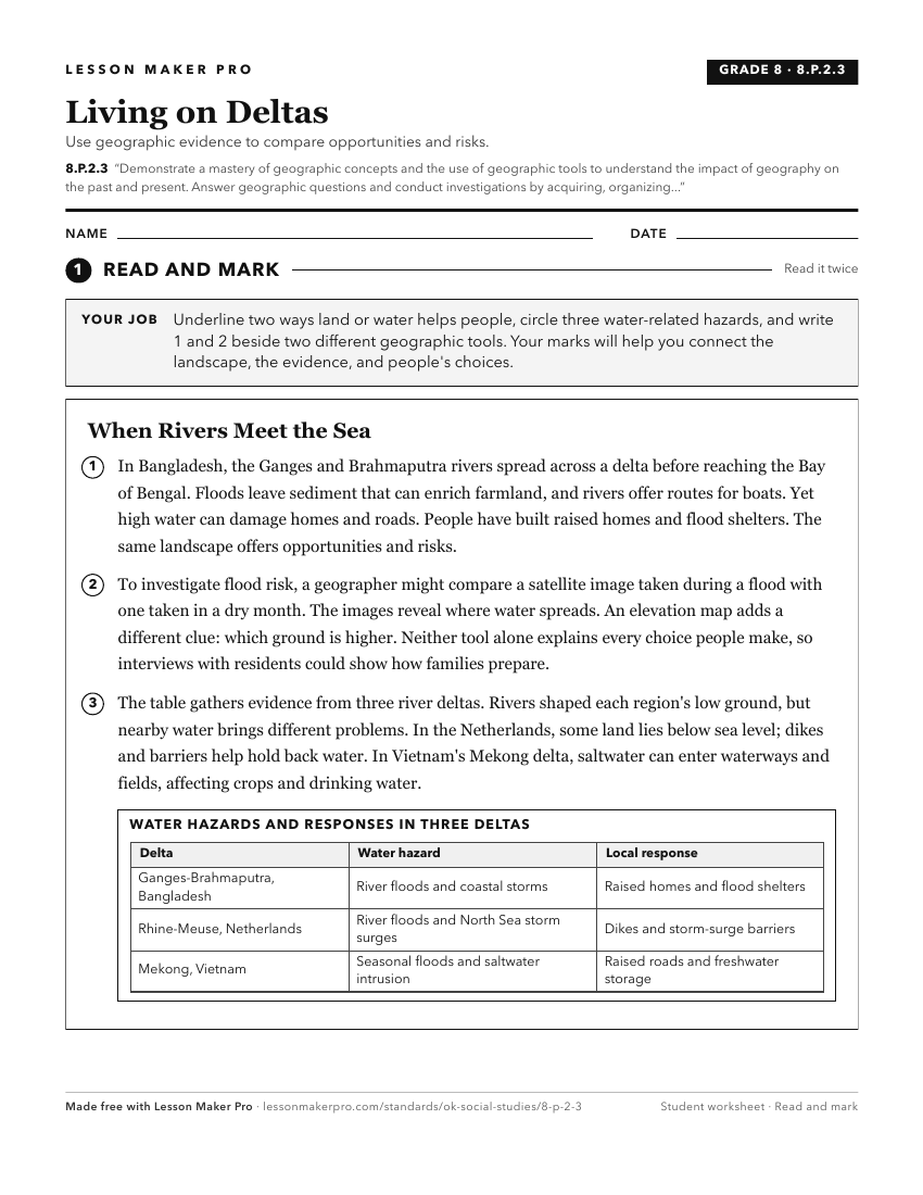
A ready-to-print activity worksheet aligned to 8.P.2.3, with an answer key for the teacher on its own page. No account needed.
PDF, US Letter, prints cleanly in black and white.
Download the worksheetKeep exploring
Related Standards
- 4.P.2.3
The 4th Grade version of this standard.
- OKH.P.2.3
Demonstrate a mastery of geographic concepts and the use of geographic tools to understand the impact of geography on the past and present.
- 7.P.2.3
The 7th Grade version of this standard.
- E.P.2.3
Demonstrate a mastery of geographic concepts and the use of geographic tools to understand the impact of geography on the past and present.
Turn this cluster into a lesson
Grade, subject, topic, and the complete cluster are prefilled. Create one free, no account needed.
Also for this cluster:Make a WorksheetMake a QuizMake a Sub Lesson