Oklahoma Social Studies 7.P.2.3.B
The Standard
- 7.P.2
- Use interdisciplinary tools to acquire, apply, and evaluate content understanding of the four strands of social studies.
- 7.P.2.3
- Demonstrate a mastery of geographic concepts and the use of geographic tools to understand the impact of geography on the past and present.
Use multiple mapping techniques, data visuals, satellite images, and geographic technology to analyze spatial patterns of physical and human characteristics, making connections between regions.
Oklahoma Academic Standards for Social Studies (2026) · 7.P.2.3
Teacher's field guide
What This Standard Means
What Students Need to Do
- Students use maps, charts, satellite images, and digital maps to find patterns in land, climate, and settlement. They compare regions using evidence from more than one source.
What Mastery Looks Like
- A student can find where rainfall and population are higher on maps and charts, then check land use in satellite images. They explain a difference between two regions without claiming rainfall alone caused it.
Common Misconceptions
- Students may read a dark color on a population map as higher elevation instead of more people. They may assume a satellite image shows rainfall or that two matching patterns prove cause and effect.
How to Assess It
- Give students an Oklahoma population map, a rainfall bar chart for Tulsa and Guymon, and labeled satellite images of both places. Ask: "How do settlement and rainfall differ? Use the map, chart, and one image as evidence."
Lesson moves
Ways to Teach It
Lay tracing paper over Oklahoma rainfall and population maps; circle Tulsa and Guymon, then mark one overlap and one difference.
Show satellite images of Tulsa and Guymon; ask, "What clues show how people use land in each place?"
Play evidence match: pair Tulsa and Guymon satellite image cards with map excerpts and rainfall bar charts, then explain each match.
Use Google Earth to choose a site for a grocery store in Tulsa or Guymon; cite nearby roads and settlement patterns.
Free download
Printable 7.P.2.3.B Worksheet
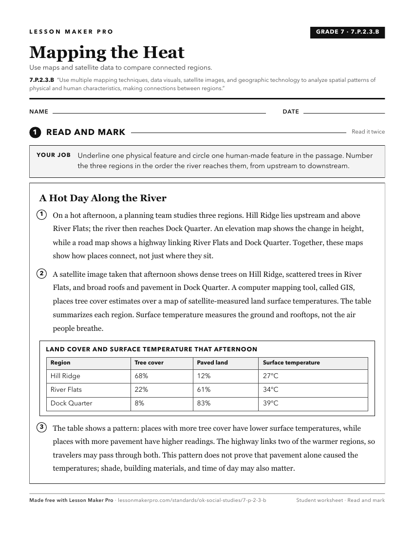
A ready-to-print activity worksheet aligned to 7.P.2.3.B, with an answer key for the teacher on its own page. No account needed.
PDF, US Letter, prints cleanly in black and white.
Download the worksheetKeep exploring
Related Standards
- OKH.P.2.3.B
Compare and analyze complex maps and mapping technologies to analyze spatial patterns of human and physical environments, explaining relationships between the e...
- AWH.P.2.3.B
Compare and analyze complex maps and mapping technologies to analyze spatial patterns of human and physical environments, explaining relationships between the e...
- 8.P.2.3.B
The 8th Grade version of this standard.
- 6.P.2.3.B
The 6th Grade version of this standard.
Turn this exact standard into a lesson
Grade, subject, topic, and the complete standard are prefilled. Create one free, no account needed.
Also for this standard:Make a WorksheetMake a QuizMake a Sub Lesson